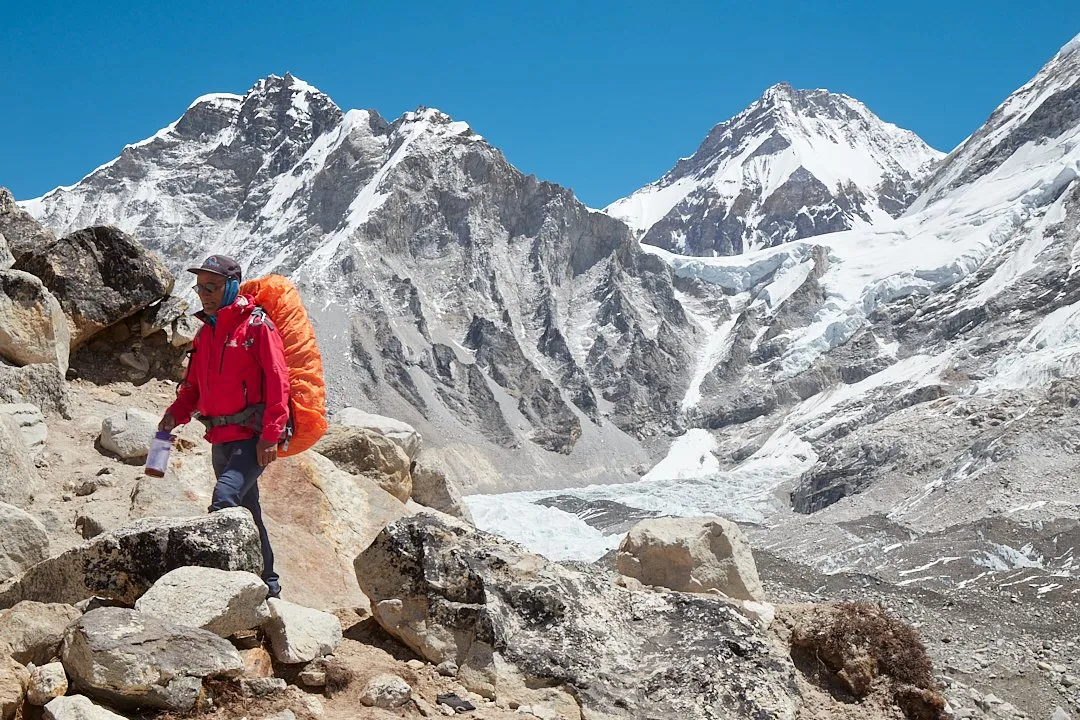
Everest — the world's highest peak at 8,848 metres — is the ultimate goal for every mountain trekker. The trek to Everest Base Camp is one of the most famous hiking routes in the world. Despite the impressive altitude of the final destinations: 5,364 metres and above, it can be completed without any mountaineering training. The entire route can also be trekked light — without tents or sleeping bags, since you can spend the nights in village guesthouses. You can hire porter-carriers to carry your pack and assist you along the way. It sounds like the perfect two-week adventure.
The route to Base Camp usually begins in Lukla, a town at an elevation of 2,860 metres. Planes and helicopters fly here from Nepal's capital, Kathmandu. The route is popular not only for the chance to see the top of the world, but also for the cultural immersion it offers. While full Himalayan authenticity has been somewhat diluted by the developed tourism industry, there is still more than enough to give you a genuine feel for Nepal's unique character.
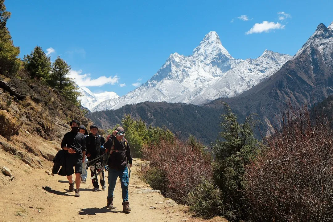
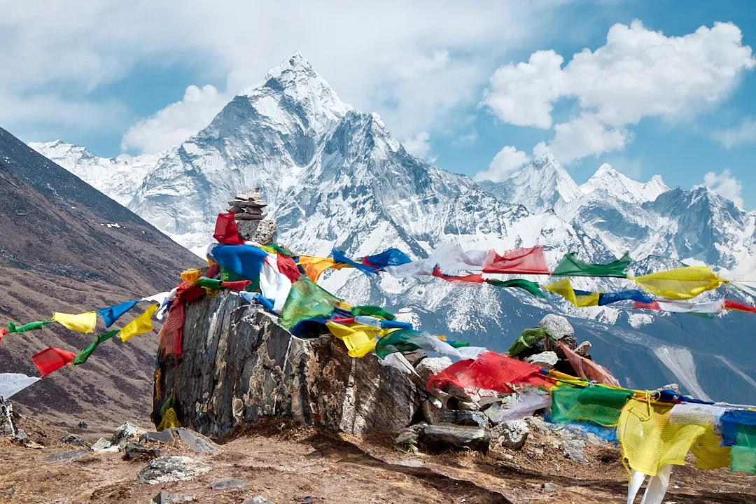
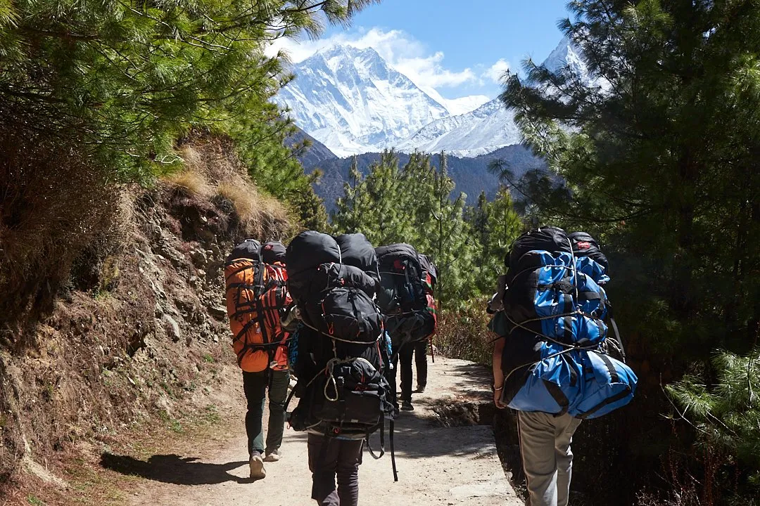
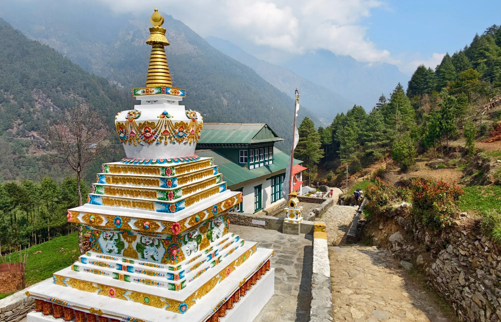
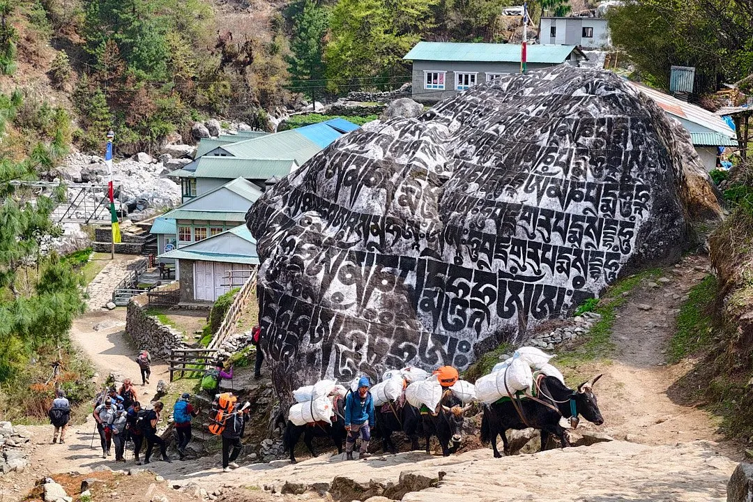
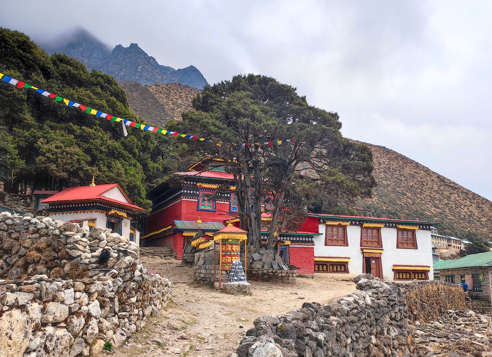
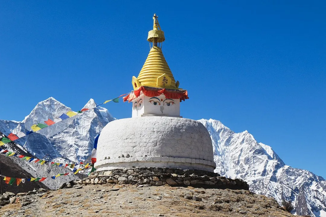
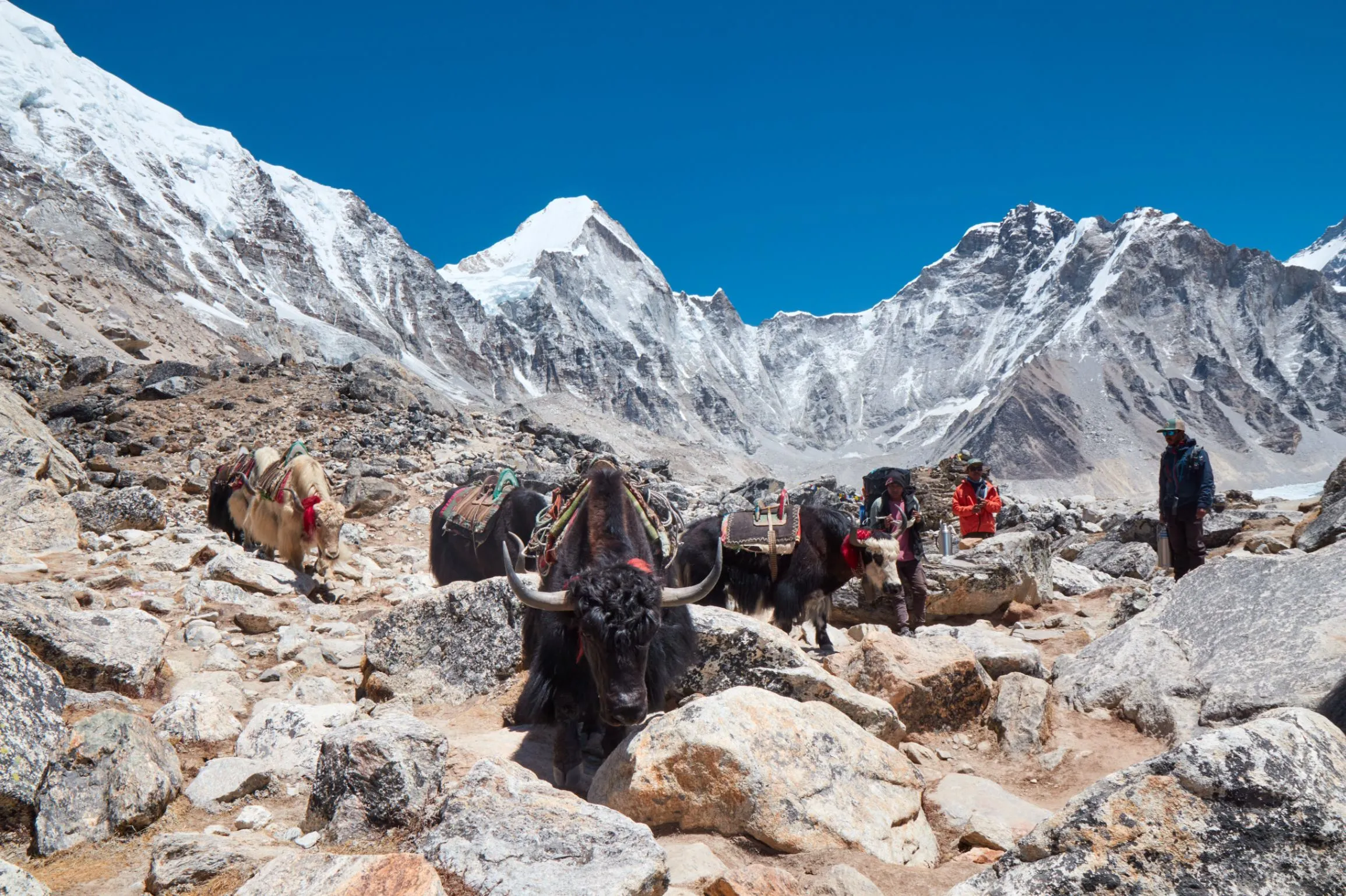
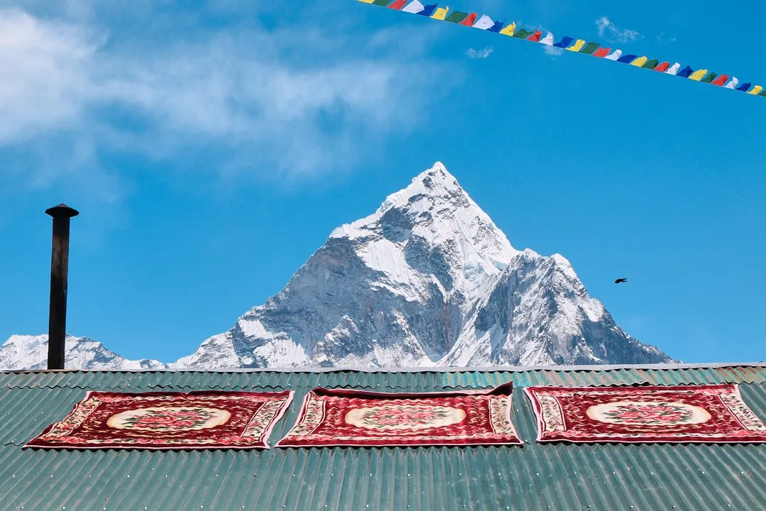
Along the way you will find ancient monasteries, small mountain villages, Buddhist stupas, and viewpoints adorned with colourful prayer flags. The air is filled with the ringing of yak bells and Nepali songs playing from the speakers of Sherpas, who keep spirits up during the long, gruelling stretches carried at altitudes of several thousand metres. You will learn about local traditions from guides and the owners of lodges — as the local guesthouses with basic amenities (beds and a shared toilet) are called — where you will be staying.
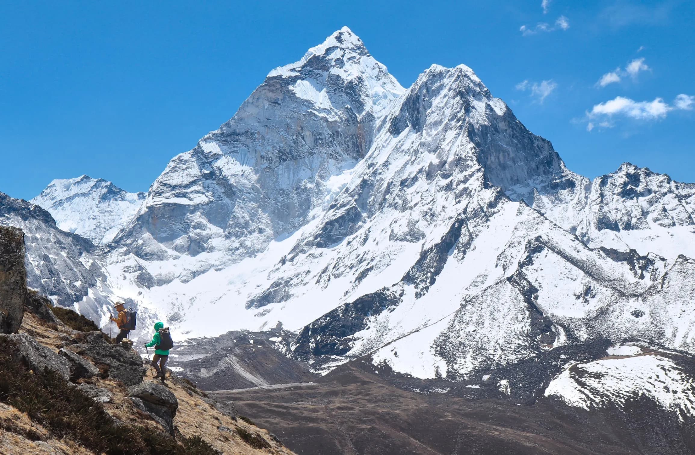
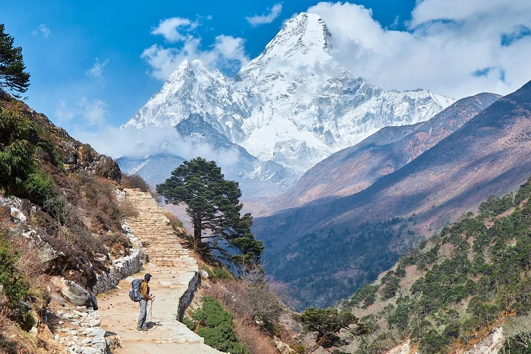
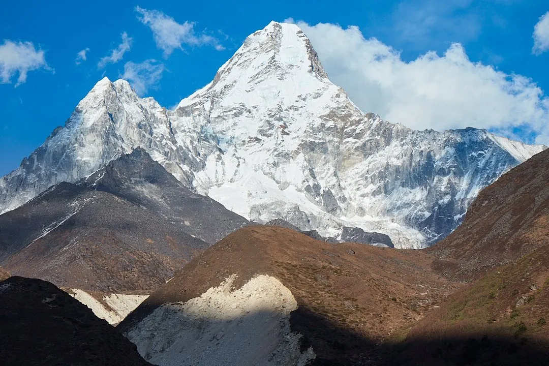
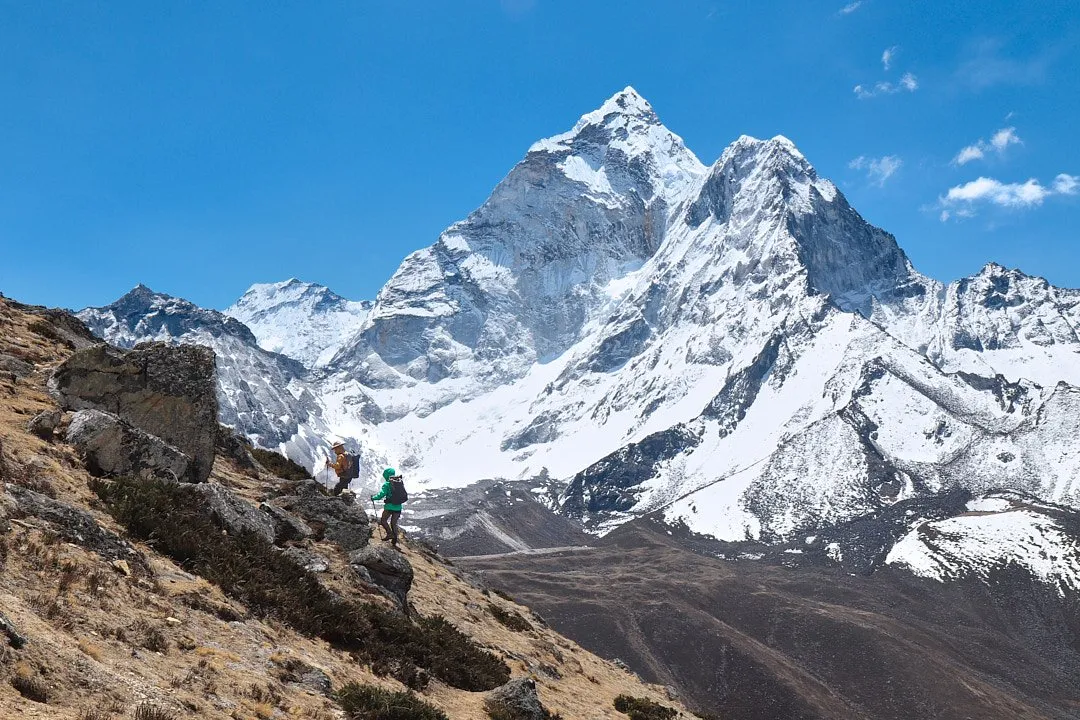
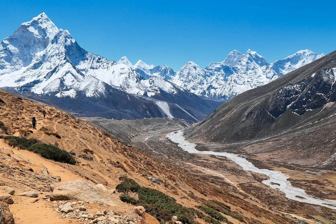
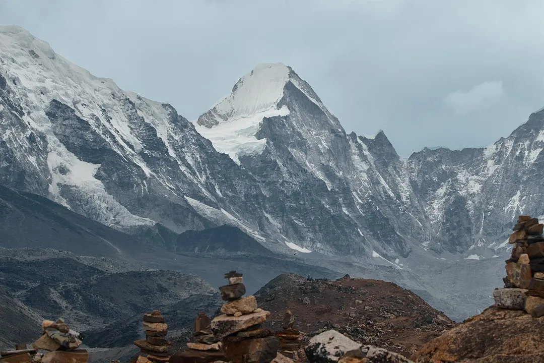
It should be said upfront that Everest itself (or Sagarmatha, as the locals call it) is best seen from the viewpoint located above Base Camp — on Kala Patthar. Throughout the trek, the world's highest peak appears lower than its neighbours, simply because those neighbours are closer. You can identify Everest by the clouds that frequently shroud its summit even in fine weather. Along the route you will encounter countless breathtaking Himalayan peaks: Ama Dablam (6,812 m), Lhotse (8,516 m), Thamserku (6,623 m), and many others.
There are several route options for reaching Everest Base Camp.
Classic (10–14 days) — the shortest route, used not only by trekkers and guides but also by porters and pack animals. This is the most popular route, and it gets increasingly busy as you approach the main destination.
Via Gokyo Lakes (14–20 days). The journey includes a glacier crossing at the Cho La pass. This is more demanding than the classic route. Some groups take the classic route on the way in and detour to the lakes on the return.
Three Passes (approximately 20 days) — crossing the Renjo La, Cho La, and Kongma La passes. A classic guided group tour, excluding flights to Nepal and Lukla, starts from 1,000 USD (1000 USD) per person. However, this trek is quite feasible to organise independently and for less money. We explain how in this article.
How to Prepare for the Trek
Trekking to Base Camp does not require mountaineering skills the way a summit climb does — for example, ascending Elbrus (5,642 meters). Although the highest point on the trekking route — Kala Patthar — is three meters higher than Europe's tallest peak. That said, endurance and experience in mountain hiking will definitely come in handy. Setting out for Base Camp with no experience whatsoever is reckless. It is also better to treat any health issues before heading out on the route, as problems tend to worsen at altitude.
Training. The type and amount of preparation you need depends on your physical condition. Before the trek, you can do cardio workouts, walk around the city with a heavy backpack, or go on a hike in the nearest mountains. The main challenge is the lack of oxygen, which becomes more noticeable the higher you climb. To train their breathing, some mountaineers recommend inflating balloons every day. In general, a healthy adult — or even a teenager — is capable of completing the route. You will most likely experience symptoms of altitude sickness, but with proper acclimatization and good physical fitness they should not prevent you from reaching the final destination. However, if you feel very unwell, it is best to descend immediately.
Medications. To feel better during the trek, many people use tablets and vitamins that reduce the strain on the body under low-oxygen conditions and help you feel more comfortable. Among trekkers, the most popular options are Hypoxen tablets, the heart vitamin supplement Panangin, aspirin to thin the blood, and electrolytes to replenish vitamins and minerals — since under conditions of physical exertion, oxygen deprivation, and mountain water that lacks beneficial trace elements, the body quickly depletes its reserves.
Diamox (acetazolamide) is the only medication with proven positive effects on the prevention of altitude sickness. You start taking it before the ascent begins — one tablet (250 mg) — and stop before the descent. However, the drug has unpleasant side effects, such as numbness and tingling in the fingers and lips, as well as a noticeable diuretic effect, so it is best to consult a general practitioner about taking it. It is also recommended to bring your iron levels to normal before the ascent.
Gear
Every trekker's gear list is personal, but here is the minimum kit worth bringing on the trek:
Main backpack (50 liters or more) with a rain cover. You should also decide upfront whether you will hire a porter or carry your own gear. If you go with a porter, you can hand your main pack to them and walk with a smaller daypack that fits clothing for changing weather, water, sunscreen, a thermos, and snacks.
Hardshell jacket and pants (protection from rain and wind), or a good-quality full-length rain poncho
Clothing for good weather — a T-shirt or long-sleeve top, shorts or convertible pants
Down jacket for trekking in low temperatures or early in the morning
Lightweight synthetic base layer for extra warmth
Trekking socks (7–10 pairs)
Trekking boots. High-ankle boots are preferable, but the route can be completed in low-cut hiking shoes or even trail-running shoes.
Cap and buff
Warm hat or balaclava
Gloves
Sunglasses
Trekking poles
Headlamp
Sunscreen (SPF 50)
First-aid kit
Toiletries
For resting at the lodge:
Spare footwear — Crocs or rubber sandals
Base layer for sleeping and light spare clothes. Lodges are cold, especially at night, so bring warm clothes for relaxing and sleeping.
Warm socks
Additional items:
A small thermos for drinking something warm on the go
Power bank. In the most basic rooms there may be no power outlets even at lower altitudes, but pricier rooms (usually with an en-suite bathroom) do have electricity even in Dingboche (4,410 m). In villages higher up it is also possible to charge devices, but only for a fee.
A lightweight sleeping bag or a liner to replace bed linen. Bedding in the mountains is rarely washed, and in some places there is none at all — just a blanket — so some kind of extra layer is essential.
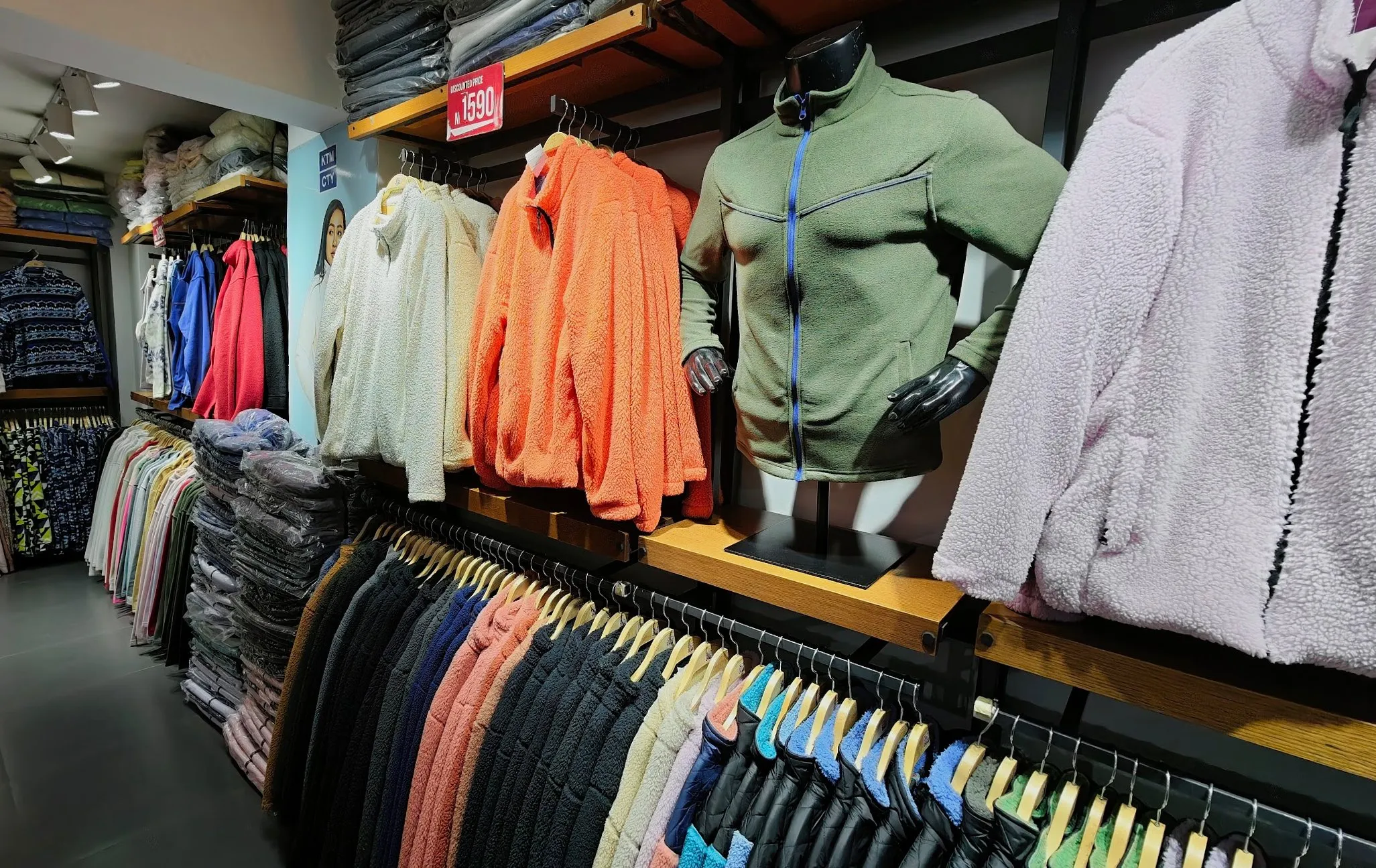
No mountaineering gear is needed for the EBC trek; regular trekking gear from mainstream outdoor shops will do. If you are missing anything, you can buy it right in Kathmandu: the city has official stores of well-known brands — The North Face, Columbia, Marmot, Rab, Black Yak, Mountain Hardwear — as well as local Nepali labels Kaemp8848 and Sherpa Adventure Gear. All of them are clustered together in the tourist district of Thamel. Prices for quality gear are high but still lower than anywhere in the world.. Thamel is also packed with shops selling knock-offs, which are often more than adequate for trekking. Buying anything serious like trekking boots here is not advisable, but simple small items are fine: socks — 100–200 rupees (0.65 USD–1.31 USD) per pair, buffs and woolen hats — from 200 rupees (1.31 USD), thin windbreakers and windproof gloves — from 600 rupees (3.93 USD), pants — from 1,000 rupees (6.55 USD), lightweight synthetic down jackets — from 1,500 (9.82 USD). The range is roughly the same everywhere, but prices vary considerably from stall to stall, so take the time to shop around and don't be shy about bargaining. Trekking clothing and equipment can also be rented, for example at Himal Outdoor. You can also sell whatever you bought for the trek there, though for very little money.
KTM CTY is a great alternative to Thamel. Locally made: a huge selection of fleece, synthetic T-shirts, and windbreakers — affordable and without fake logos.
Ontrack by Decathlon is a recently opened store in Lalitpur carrying Decathlon products. The selection is not as broad as in a full-size Decathlon, but basic trekking essentials are available.
Where to Find a Porter and Guide
Since 2023, the Nepalese authorities have introduced a mandatory requirementstating that trekkers may not head to Everest Base Camp without a guide or porter. However, to this day this rule is ignored by many national park administrations, including Sagarmatha National Park (where Everest is located). When purchasing permits and at checkpoints, staff will ask about your route, the expected number of days, and whether you have a guide — but saying you are going independently satisfies everyone. There is no need to claim you are only going as far as the nearest village or that you got separated from a group.
A guide is useful if you want to learn more about the history and culture of the region and do not want to spend time planning the route yourself. A porter will make the trek physically easier by carrying most of your belongings. Guides and porters also help with booking rooms at lodges, placing breakfast and dinner orders, and recommending cafes along the route. That said, if you are unhappy with a place they have chosen for any reason, do not hesitate to say so and make a different choice.
You can find a guide and porter in advance: ask in chats and Facebook groups or contact one of the many travel agencies whose signs appear on almost every street in central Kathmandu. Independent travelers more often look for guides and porters once they reach Lukla, asking at lodges or agencies (chances are any Lukla local who speaks English will be able to point you in the right direction). You can also hire guides and porters in Namche Bazaar, though it is harder to do so there as there are fewer of them available — on the plus side, you will end up paying for a couple of days less.
Porter services typically cost around 20 USD per day; agencies may charge more. If you are looking for a porter in Lukla, it is quite possible to negotiate and bring the price down to 2,500 rupees (16.4 USD) per day. Porters often offer to act as a guide as well — this is common practice. The cost of guide and porter services increases every year. If you need a guide on the route, we recommend Nogen (+977 986 678 83 21, WhatsApp).
Upon a successful trek it is customary to tip; the current going rate is around 100 USD, though this is personal and depends on how well the porter and guide do their job. They typically help book rooms at lodges, place breakfast and dinner orders, and take you to good cafes along the route. Porters and guides pay for their own food and accommodation. Prices are set lower for them than for tourists, and at night they sleep in separate rooms. Agree on payment terms in advance: when you will hand over the money and in which currency.
It is also advisable to check the health of your porter and guide with the agency in advance, or ask them directly if you are hiring independently. Ask whether their footwear and clothing are in good condition, and whether they drink alcohol during the trek. By talking with a person face to face, you can get a general sense of whether you will be comfortable with them. It is rare but it does happen that a porter or guide leaves the route early due to illness or, for example, problems with their footwear or clothing.
Money
During the trek, you can pay with cash only in almost all places. There are ATMs in Lukla, Namche Bazaar, and a few villages along the way, but there is no guarantee that they will have money or that they will be working at all. It is therefore best to withdraw all the money you need in Kathmandu. Depending on the bank, you can withdraw between 10,000 and 35,000 rupees at a time in Nepal (65.5 USD–229.1 USD) with a fee of 500–700 rupees (3.27 USD–4.58 USD). Check the limits and fees at each ATM.
Connectivity
Nepal has two mobile operators — N-Cell and Nepal Telecom (Namaste). On the trek to Everest Base Camp, Ncell offers better coverage. Signal is available in almost all major villages up to 4,000 metres, though coverage is far from ideal. Even in Gorakshep at 5,140 metres there is a weak signal — enough to read and send messages in messengers.
At the airport, a tourist SIM card valid for 28 days with unlimited data (though speeds are throttled after 25 GB) costs 2,000 rupees (13.1 USD). In the city you can buy a regular SIM card and activate a plan on it — it will work out slightly cheaper.
With the spread of international eSIMs (Airalo, Unisim, and others), for short trips it is often more convenient and cost-effective to use them rather than bothering with local SIM cards. The moment the plane lands, you already have a connection.
We published a comprehensive guide to the most popular eSIM providers — it covers everything about what an eSIM is and which operators connect best in which country.
Here are the rates of the most popular eSIM providers for Nepal:
• Trip.com — 10 GB for 30 days costs $20.
• Yesim — 10 GB for 30 days costs $29 (29 USD).
• Airalo — 10 GB for 15 days costs $23 (23 USD). Promo code for new users — TRAVEL7460.
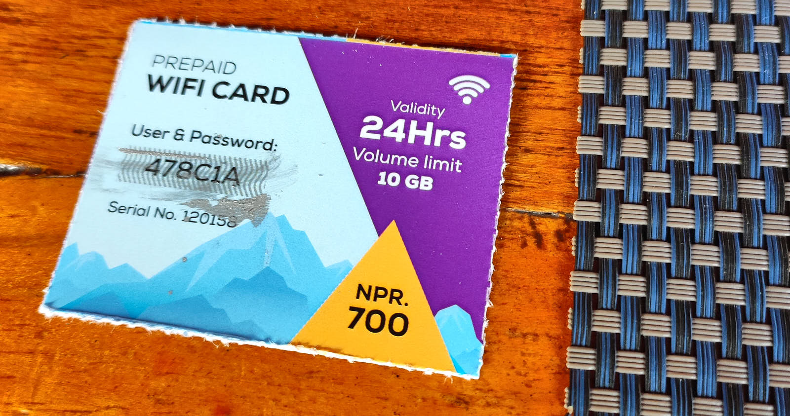
In lodges located above 3,500 metres, you can buy a Nepal Airlink internet voucher for 24 or 48 hours for 600–1,000 rupees (3.93 USD–6.55 USD). Internet prices also rise with altitude and in Gorakshep reach 1,200 rupees (7.86 USD) for 24 hours of access. If you buy a voucher in the evening at one lodge, you can use it at another lodge until the 24 or 48 hours expire. The voucher works on one phone only, but it is sometimes possible to disconnect and log back in from a different device. The main problem with vouchers is that they connect via Wi-Fi, so it is better to choose a room with a good signal from the start.
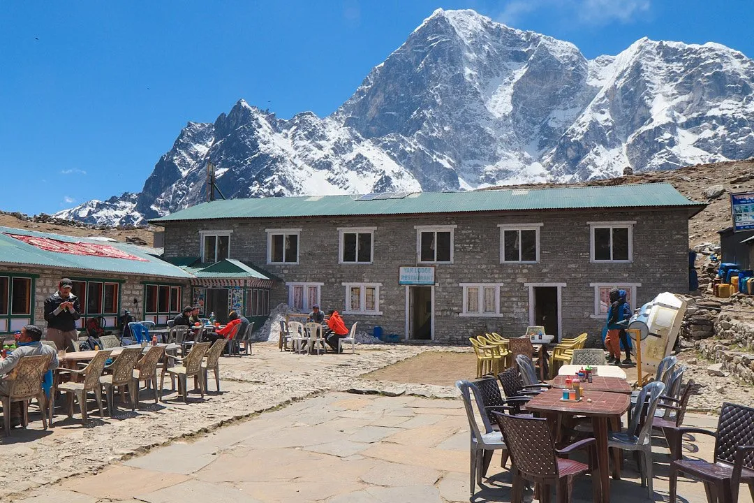
Accommodation and Food
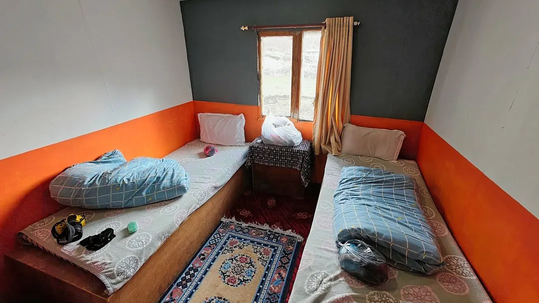
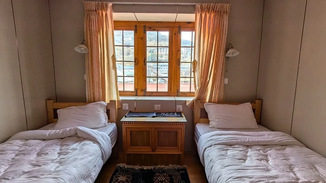
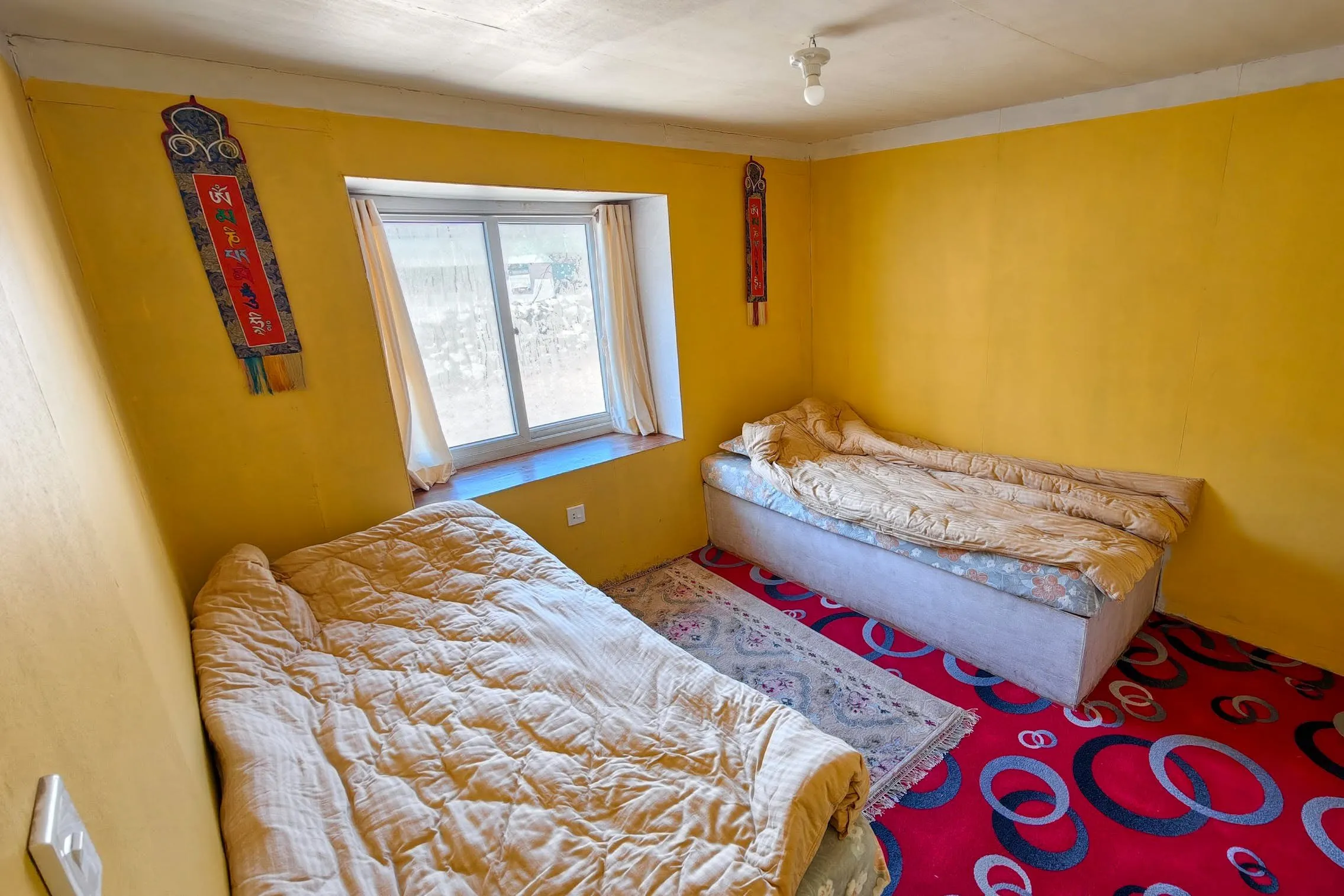
Tents are a rarity on the Everest Base Camp trek — trekkers almost always stay in lodges. As a rule, you spend four to eight hours walking each day. On shorter days you can afford to sleep in a little, but on long stages you will need to be up by five or six in the morning. The typical routine is to wake up, have breakfast at the lodge (ordered the evening before), set off at seven or eight, have lunch at a café along the way or at the next lodge where you will be spending the night, and finish the day with dinner before bed.
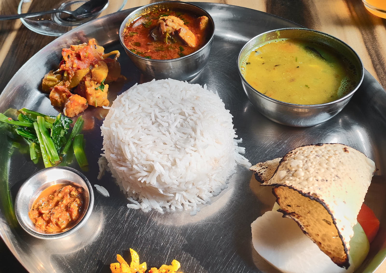
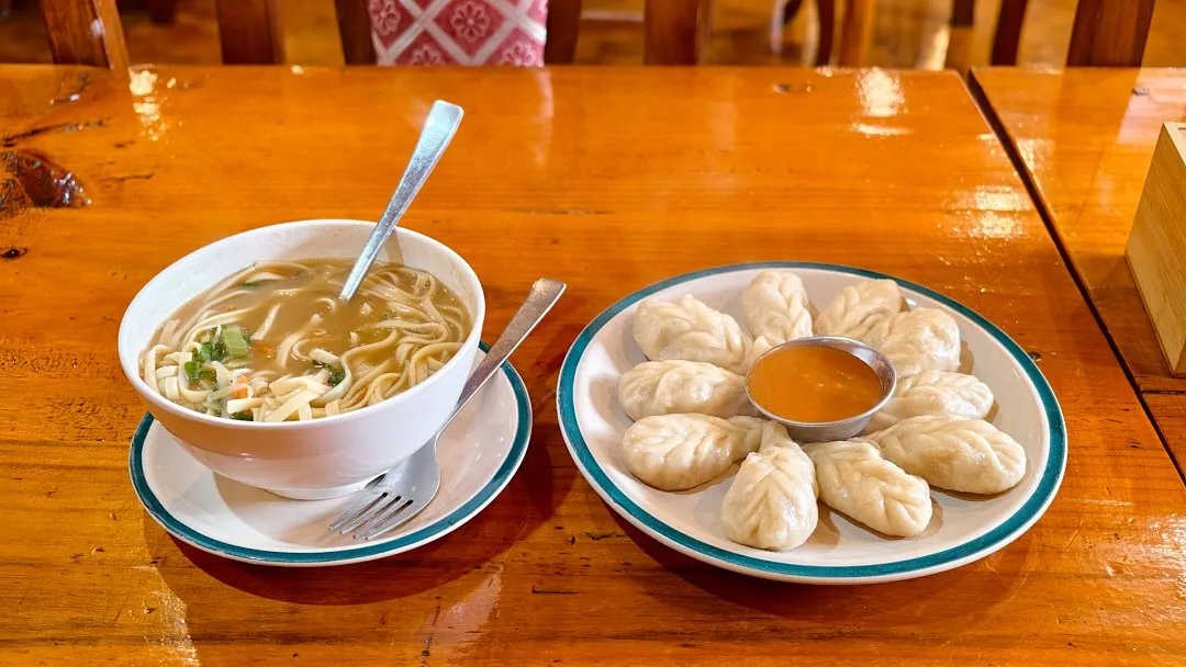
Lodge breakfasts are simple: eggs or omelette, flatbreads, muesli, and porridge — rice porridge or the traditional tsampa made from roasted barley. Ginger tea with lemon and honey and masala chai are popular drinks. It is usually possible to order items from the regular menu at breakfast too. The most popular dishes among trekkers are the national Nepali dish dal bhat (unlimited boiled rice served with variations of lentil soup, vegetables, meat, potato, and sauces), curry with flatbreads, fried noodles (chow mein), or rice with chicken or buffalo meat (at higher villages it is advisable to order the latter with caution, as supply difficulties can mean it is not the freshest), a hearty noodle soup called thukpa, garlic soup (which Nepalis say helps with altitude sickness), local dumplings momo with various fillings, and the thick, nourishing Sherpa stew. Western food also features, albeit in a local interpretation — you can almost always order chips, burgers, yak steak, spaghetti with yak cheese, or pizza. Apple pie is a popular dessert (just make sure it is fresh). The most popular salad is tomato with mayonnaise.
Along the trek you will come across signs advertising yak cheese for sale — give it a try, it is quite rich and nutritious. 100 grams costs 350 rupees (2.29 USD).
The higher you go, the more expensive accommodation and food become. Lodge stays remain a small part of your overall costs; the main outlay on the route is food. You generally eat where you sleep, otherwise you will be charged more for the room. The cost of a night in a lodge when you dine there is 500–1,000 rupees (3.27 USD–6.55 USD) for a room with a shared bathroom and 2,500–3,000 rupees (16.4 USD–19.6 USD) for a room with a private bathroom — these rooms (at altitudes up to 4,500 metres) usually have a power socket and even hot water. If you are in a room without a private bathroom, a hot shower will cost 500–1,000 rupees (3.27 USD–6.55 USD) depending on altitude. Most lodge rooms have two beds, though some have three.
The cost of charging devices also rises with altitude, but up to Lobuche there are lodges with sockets in the rooms. For the night in Gorakshep and the descent, a power bank should be sufficient, or you can pay to charge your devices. A full smartphone charge in Lobuche or Gorakshep will cost 500–700 rupees (3.27 USD–4.58 USD).
Food and water prices also climb with altitude — and at elevation you need to drink a lot of water, up to three litres a day. For example, a portion of fried noodles in Lukla costs 700 rupees (4.58 USD), while in the highest settlement, Gorakshep, it already costs 1,400 (9.17 USD), and a litre of water that you can buy for 60 rupees (0.39 USD) in Lukla will cost 400 rupees (2.62 USD) at altitude. You can also order boiling water at lodges to brew your own drink and fill a thermos for the trail. Dinner orders are usually placed by five in the evening, and breakfast is ordered straight after dinner. If you are travelling with a guide, they will bring you the menu, serve your food, and clear the dishes.
Payment for accommodation and food is made before you leave — the lodge owner will tally up all the items and tell you the total. In the few places where card payment is accepted, an additional 5% will be added to the bill.
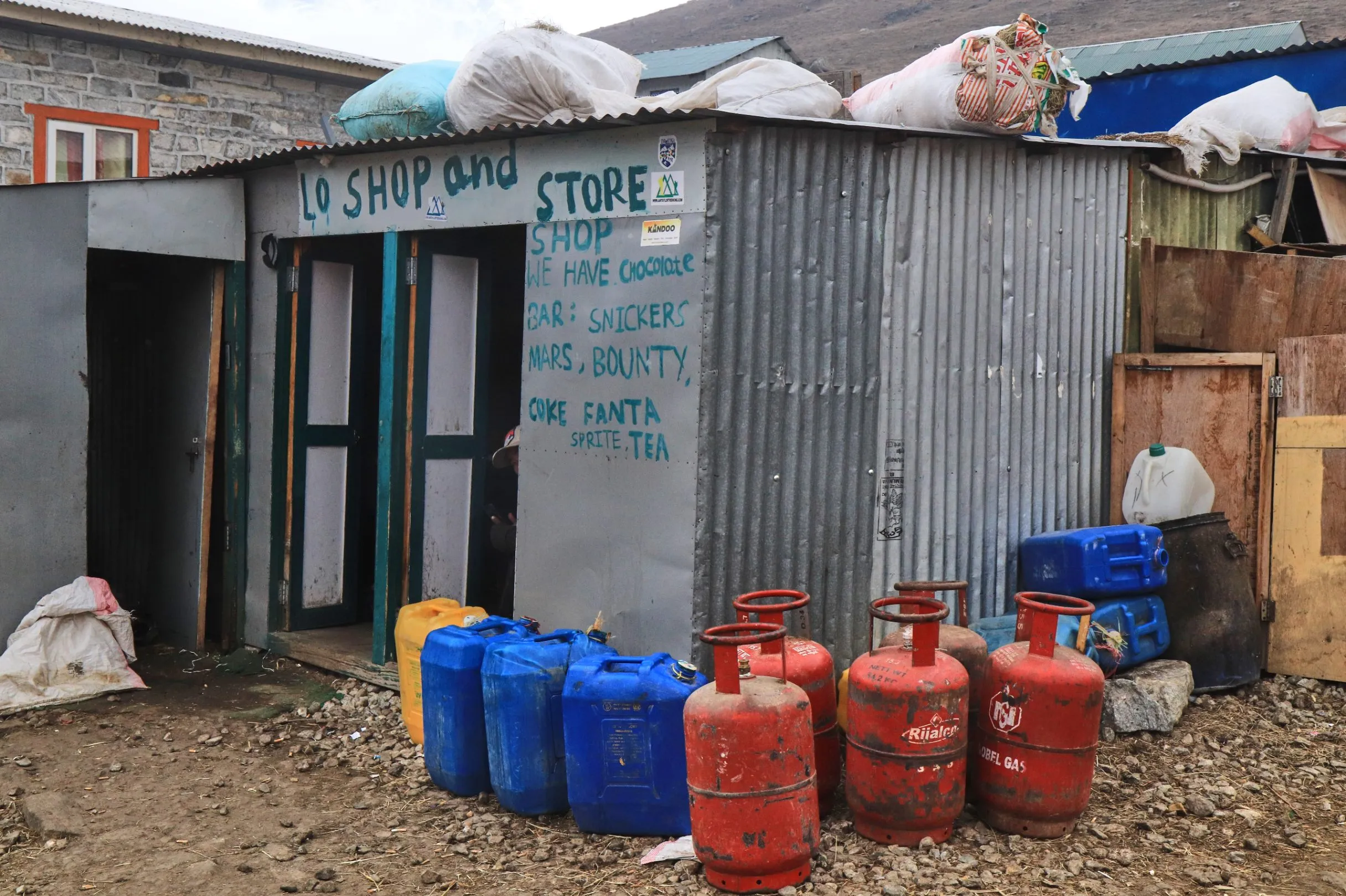
In every village along the route (even in Gorakshep) there are small shops where you can buy water, soft drinks, toilet paper, biscuits, chocolate bars, and even beer — prices there are always slightly lower than at the lodges.
Permit
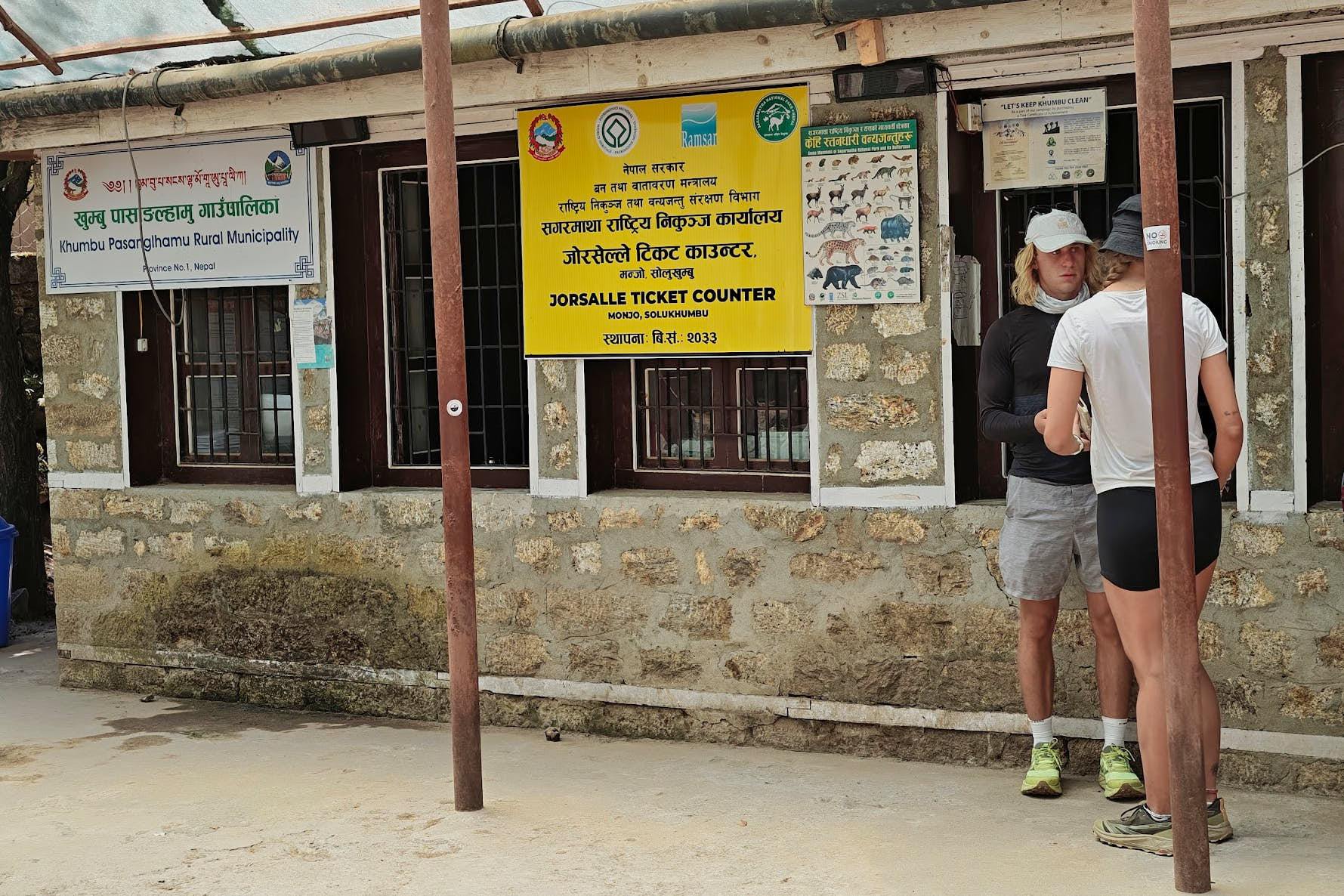
The trek to base camp passes through Sagarmatha National Park. The permit to enter this area costs 3,000 rupees (19.6 USD), plus another 3,000 rupees (19.6 USD) paid to the local municipal treasury. The documents can be processed at checkpoints: at the exit from Lukla at the very start of the route, or after the village of Monjo.
How to Get to Lukla
Lukla is the starting point for the trek to Everest Base Camp. The town sits at an elevation of 2,860 meters, and most trekkers skip acclimatization entirely, even if they flew into Kathmandu from sea level and headed straight to Lukla. That said, everyone is different, and some people may feel unwell, so it's worth building in an extra day for acclimatization in Lukla.
By air. Flights operate from airports in Kathmandu and Ramechhap. Getting there from Kathmandu is more straightforward — from the city center you can reach the airport in about half an hour. However, during high season there are fewer flights from the capital. Getting to Ramechhap requires around five to six hours by transfer costing from $20 (20 USD), and you'll need to budget time and money for an overnight stay, since planes depart only in the early morning.
Only local airlines fly to Lukla: Tara Air, Summit Air, Yeti Airlines, Sita Air. These are small, aging planes with two seats per row — flights like these don't even show up on FlightRadar. Tickets can be purchased on the airlines' websites (which frequently crash). If you can't find a ticket for your preferred date, try emailing the airline directly — they respond quickly, and often that's exactly how you manage to snag the tickets you need. You can also book a flight through a travel agency or hotel, which will cost roughly ten dollars (10 USD) more. Try to book the earliest flight possible: it gives you a better chance of actually getting out. Airlines have no problem refunding money if a flight doesn't depart, but you'll lose time. You can check flight status at the desks or offices of the airlines at Lukla and Kathmandu airports. The same offices handle ticket refunds, or you can write to them by email. A round-trip ticket from Kathmandu to Lukla costs around $500 (500 USD), with a flight time of just 30 minutes. Luggage over ten kilograms incurs an extra charge of one dollar per kilogram.
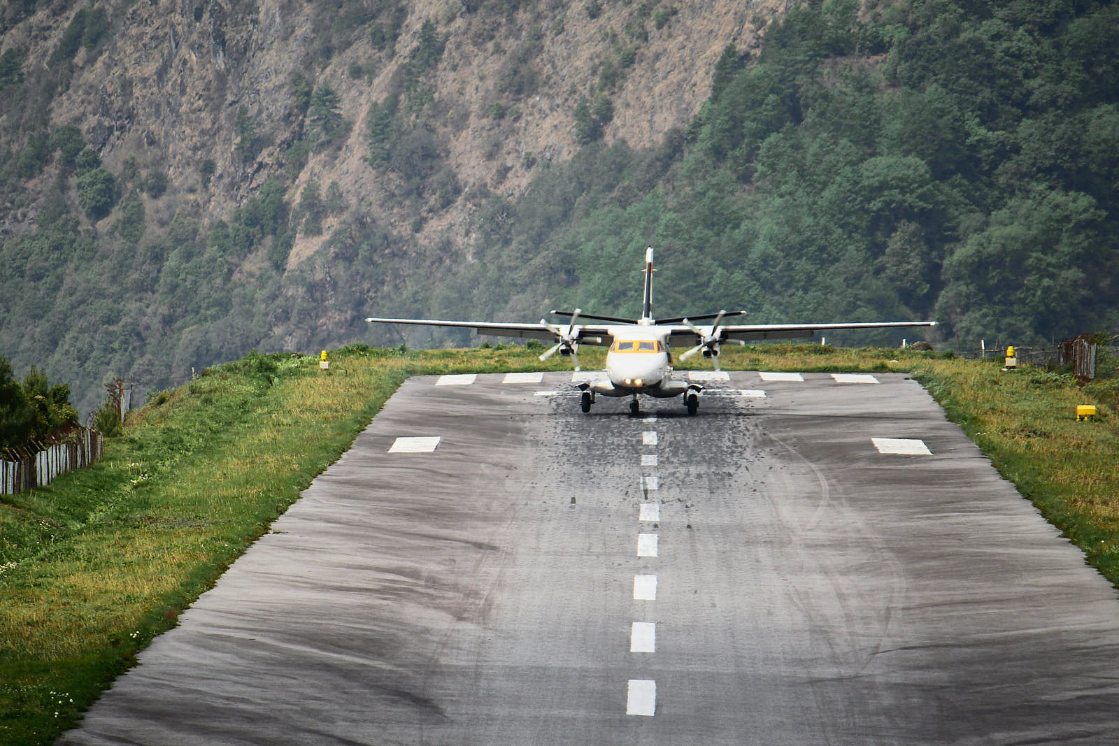
Lukla Airport is considered one of the most dangerous in the world. The runway is just 520 meters long and ends at a cliff edge. Conditions are further complicated by the unpredictable mountain weather, which tends to deteriorate toward the second half of the day — and often in the morning as well.
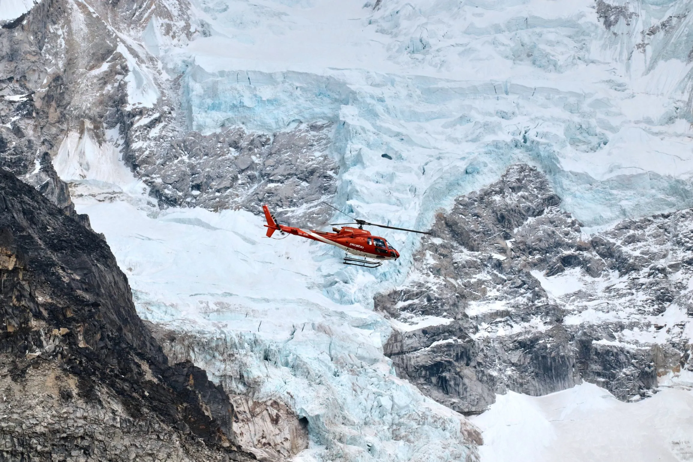
Flying by helicopter guarantees departure, but tickets cost more. Agencies quote prices starting from $500 (500 USD) per person one way. Sometimes, however, you can fly for as little as $300 (300 USD) — for example, if someone couldn't make their flight and seats become available. If you're lucky, in the event of a cancelled flight you may be able to buy a helicopter ticket at one of the company offices located in the building near the helipad, on the opposite side from the airport. Unlike with planes, there is no extra charge for luggage when flying by helicopter.
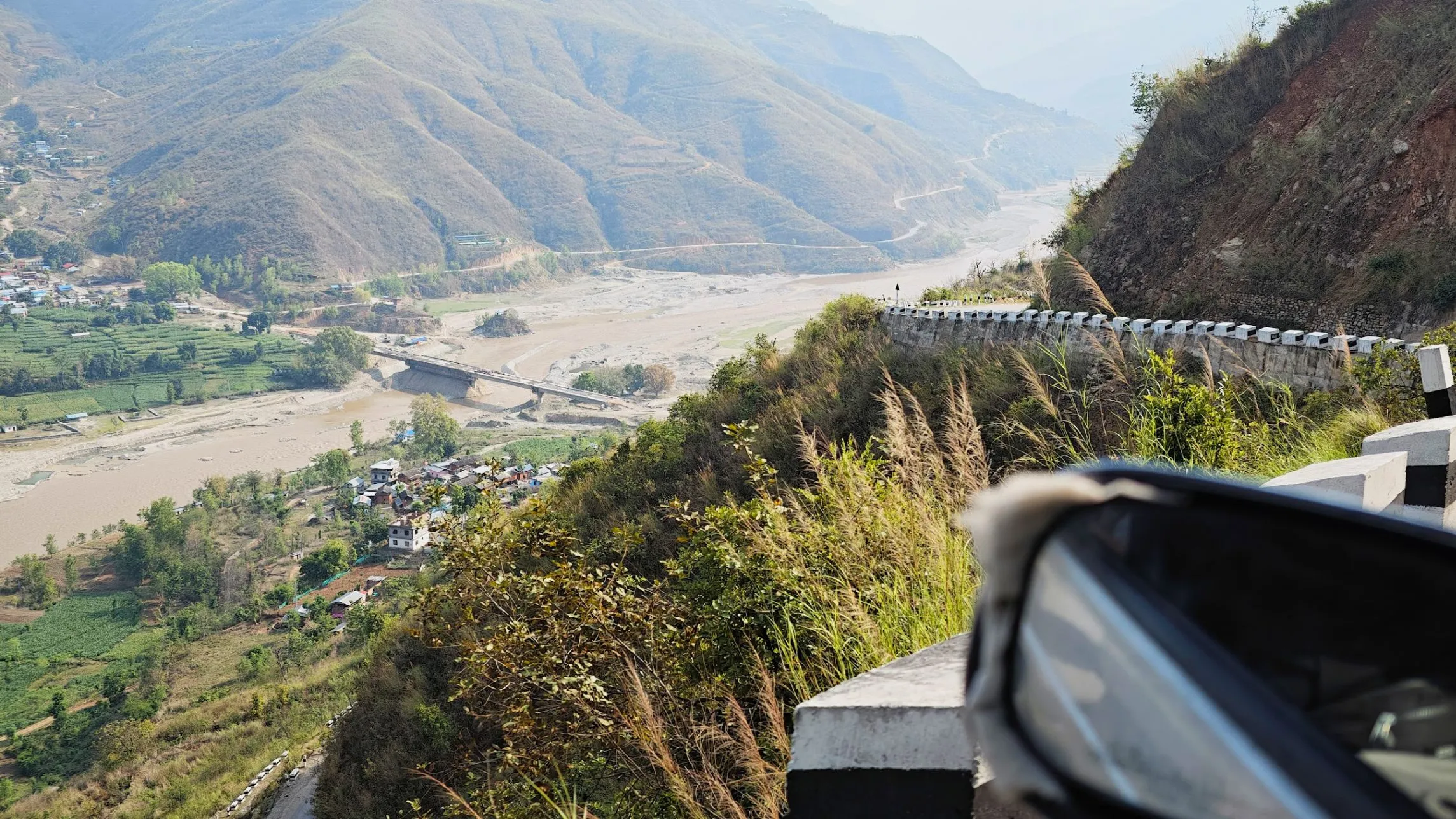
By land. Getting to Lukla overland takes two days, but this route is far less dependent on weather and is significantly cheaper than flying. As of 2026, you can already drive as far as Surke — a small village about 2.5 hours on foot from Lukla. The first step is to get from Kathmandu to Saleri by bus for 1,800 rupees (11.8 USD) per ticket, or by jeep for 3,000 (19.6 USD).
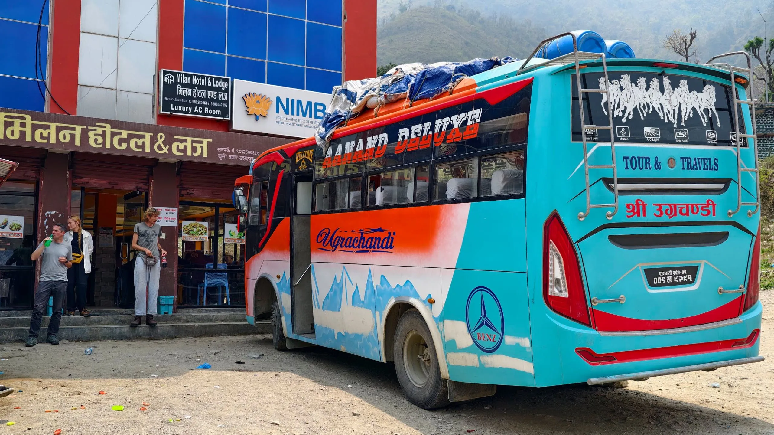
The bus leaves Kathmandu at five in the morning and takes a couple of hours longer than the jeep, but you get your own seat that you don't have to share with anyone (jeeps often fit four people across three seats). It's best to buy tickets at least a day before departure at one of the booking counters in Chabahil for Saleri or Phaphlu (the neighboring village). The best seats are in the middle of the bus — rows 5 to 10: near the front door, touts are constantly shouting and locals who ride standing crowd together, while toward the back the motion sickness is worse. The road is tough with a lot of switchbacks. There will be lunch stops along the way, but the food quality isn't great, so stock up on snacks.
The bus arrives at its final stop (Phaphlu) at around 17:30. Even before pulling in, locals will board the bus and start offering jeeps to Surke for the following morning. You can arrange this on the spot, or book a jeep later through the owner of the lodge where you spend the night. The price of a jeep to Surke is 3,000 rupees (19.6 USD). You can stay at the Peaceful Phaphlu hotel — a clean double room with electric blankets, a private bathroom, and hot water costs 2,500 rupees (16.4 USD).
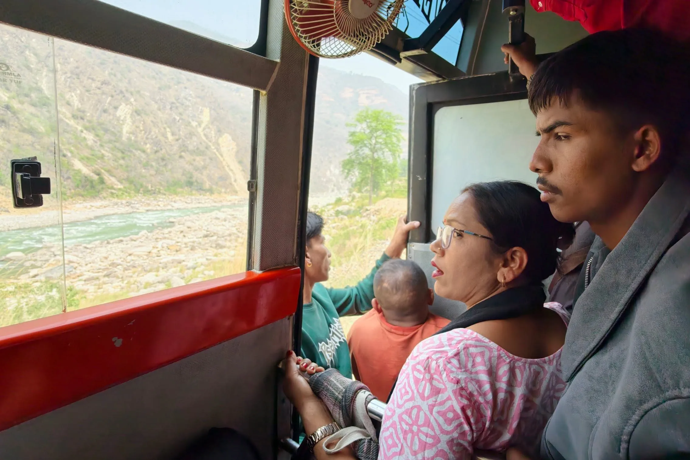
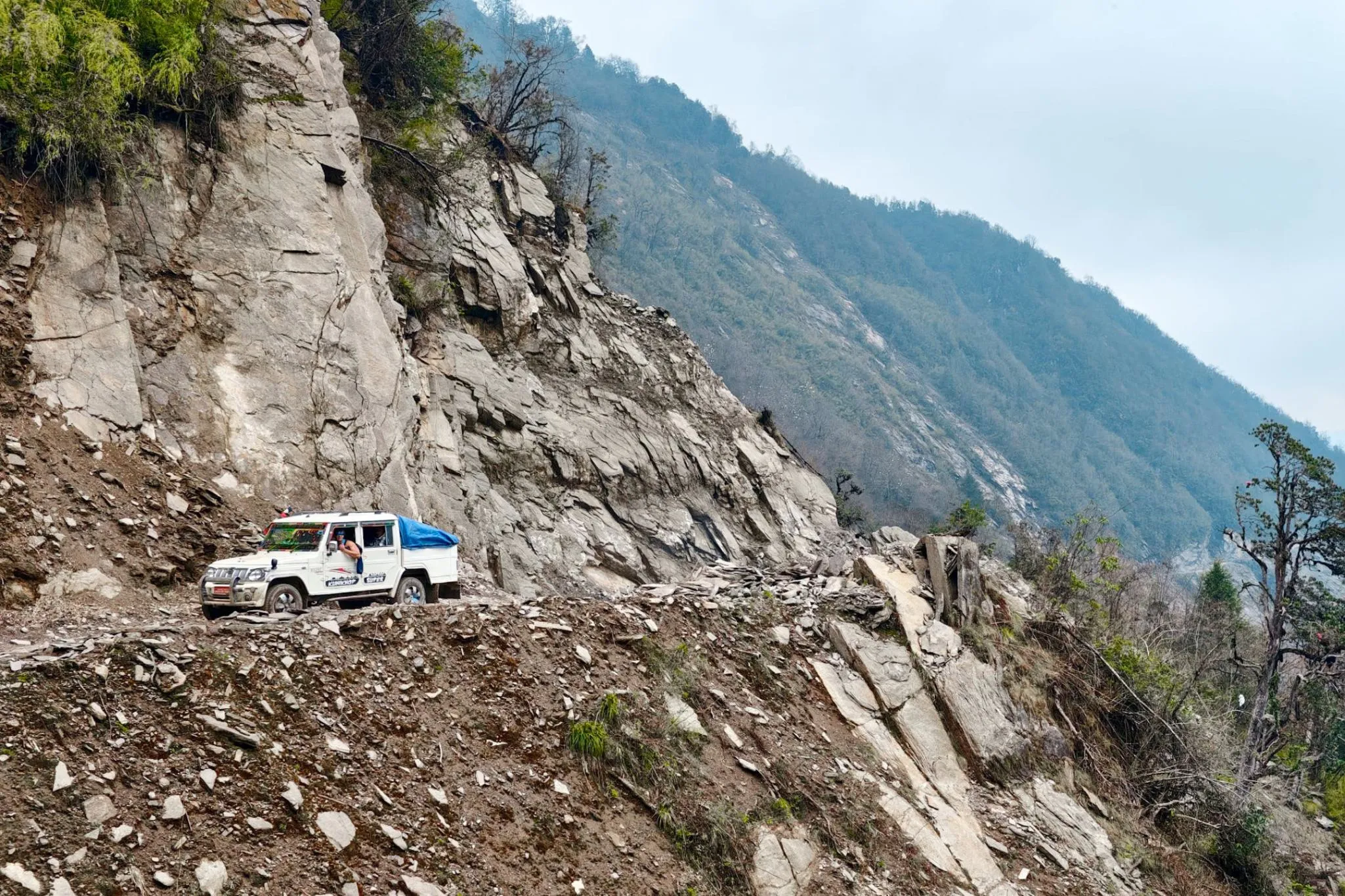
Jeeps from Saleri/Phaphlu depart between 7:30 and 8 in the morning and reach Surke by around 4 to 5 in the afternoon. Parts of the road are ordinary dirt track, while other sections are washed out by streams and mountain rivers — a badly battered ribbon no more than a couple of meters wide, churned up by the wheels of jeeps and heavy trucks hauling gas and supplies into the mountains, running along a mountainside above a sheer drop. There will be one or two stops for breakfast or lunch along the way.
If you have the energy and time, you can climb from Surke to Lukla in 2–3 hours — it's about 600 meters of elevation gain: there's a wide choice of lodges, cafes, and small shops. If you're out of energy or time, stay the night in one of the few lodges in Surke and start the trek the following morning, bypassing Lukla on the left — the road meets the main route at the village of Cheplung.
Route map
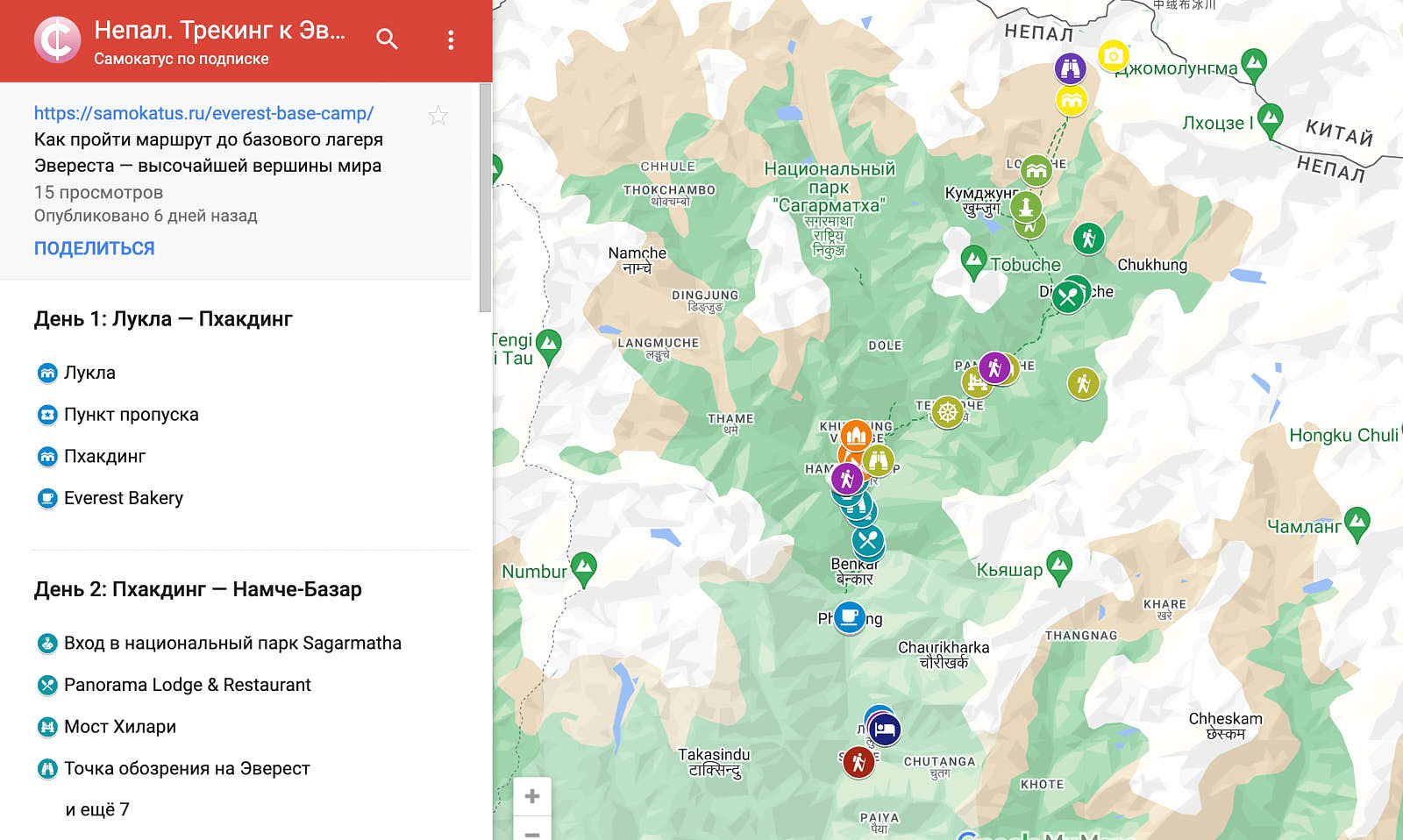
Route
Day 1: Lukla — Phakding
Eight kilometers
The first day of trekking involves a short transfer that leaves room for a delayed flight, a leisurely breakfast in Lukla, finding a guide or porter, and buying any last-minute gear. At the checkpoint on the way out of Lukla, you need to purchase a permit for Sagarmatha National Park. Only cash is accepted, and you will need to show your passport to complete the formalities.
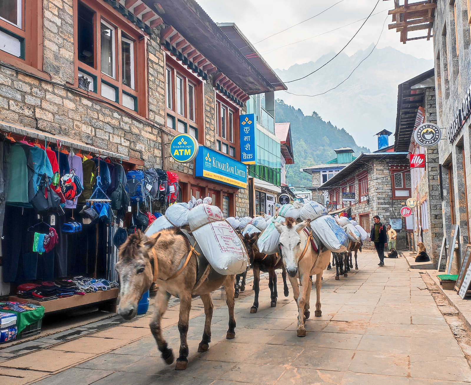
The walk to the village of Phakding takes about three hours. There are no significant changes in elevation along this section. The wide trail runs along a forest past several villages, and along the way you will encounter Buddhist stupas and large boulders — Mani stones carved with mantras. The same path is used by yaks and mules carrying goods, and by porters loaded with tourists' belongings, gas canisters, food, and items for sale. Accommodation prices in Phakding are low — 500 rupees (3.27 USD) per room. Meals will cost around 300–500 rupees (1.96 USD–3.27 USD) per person per dish, not including tea or coffee. The village has several bars and a branch of the Everest Bakery café-bakery chain.
Alternative route
If you reached the start of the trek by jeep, you do not have to go up to Lukla from Surke — instead, you can bypass it on the left and join the main trail in the village of Cheplung, then continue on to Phakding. The distance from Surke to Phakding is ten kilometers with no steep climbs. It is quite feasible to walk another five kilometers further to the village of Monjo, where you can obtain your permit straight away so you don't have to queue the following morning.
You can stay in Monjo at Buddha Lodge — a room with a power outlet and views of the valley and a Buddhist monastery costs 500 rupees (3.27 USD).
Day 2: Phakding — Namche Bazaar
11 kilometers
The route runs through the canyon of the Dudh Kosi River. The terrain is more varied on this day, with both ascents and descents. Along this section, past the village of Monjo, is the largest checkpoint on the route. Trekkers are sometimes asked to open their backpacks and say who they are hiking with. Rangers are mainly looking for drones, which require a special permit. If you have hired a guide, they will handle all communication with checkpoint staff.
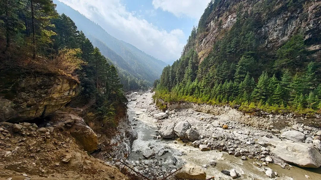
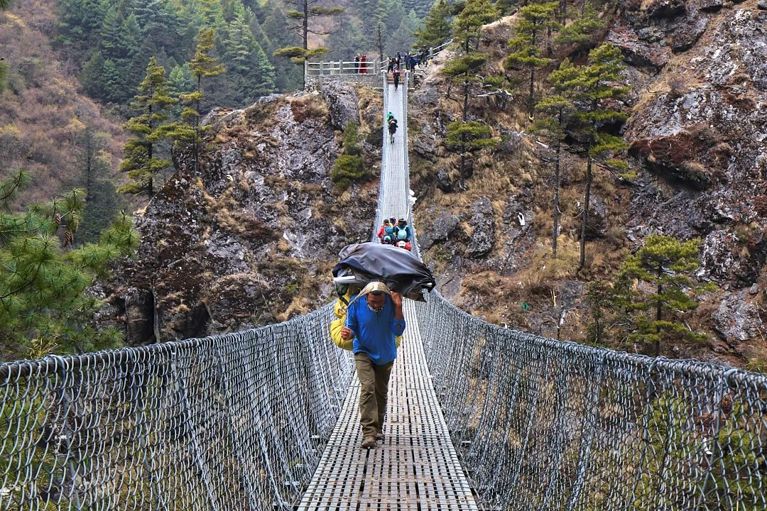
On the way to Namche Bazaar you can stop for a bite at a lodge or café in one of the villages. Panorama Lodge & Restaurant offers a great view of a sheer rock face popular with climbers on one side and a suspension bridge on the other. Suspension bridges are an integral part of this trek. The most famous of them is the Hillary Bridge, named after the first person to summit Everest, New Zealander Edmund Hillary. Its lower tier was once used as a platform for rope jumping, but is now closed. The upper section sits at a height of 135 meters. All the suspension bridges along the route are used not only by trekkers but also by animals, which sometimes cause traffic jams.
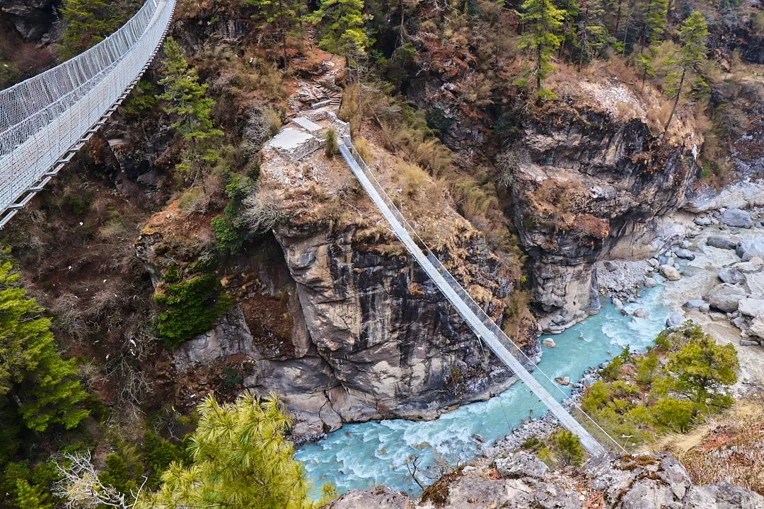
Just past the Hillary Bridge is the first viewpointfrom which Everest is visible. If the weather is on your side, you can spot it through the trees. Just before Namche Bazaar, immediately after a long climb through the forest, there is another checkpoint.
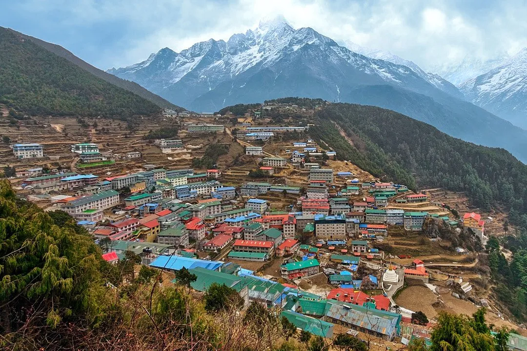
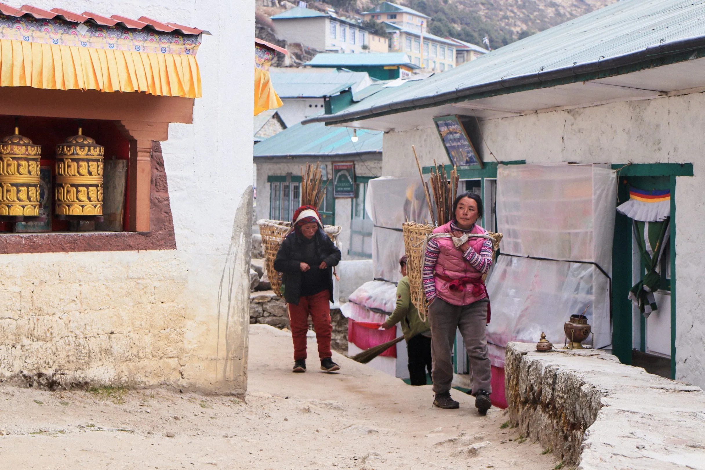
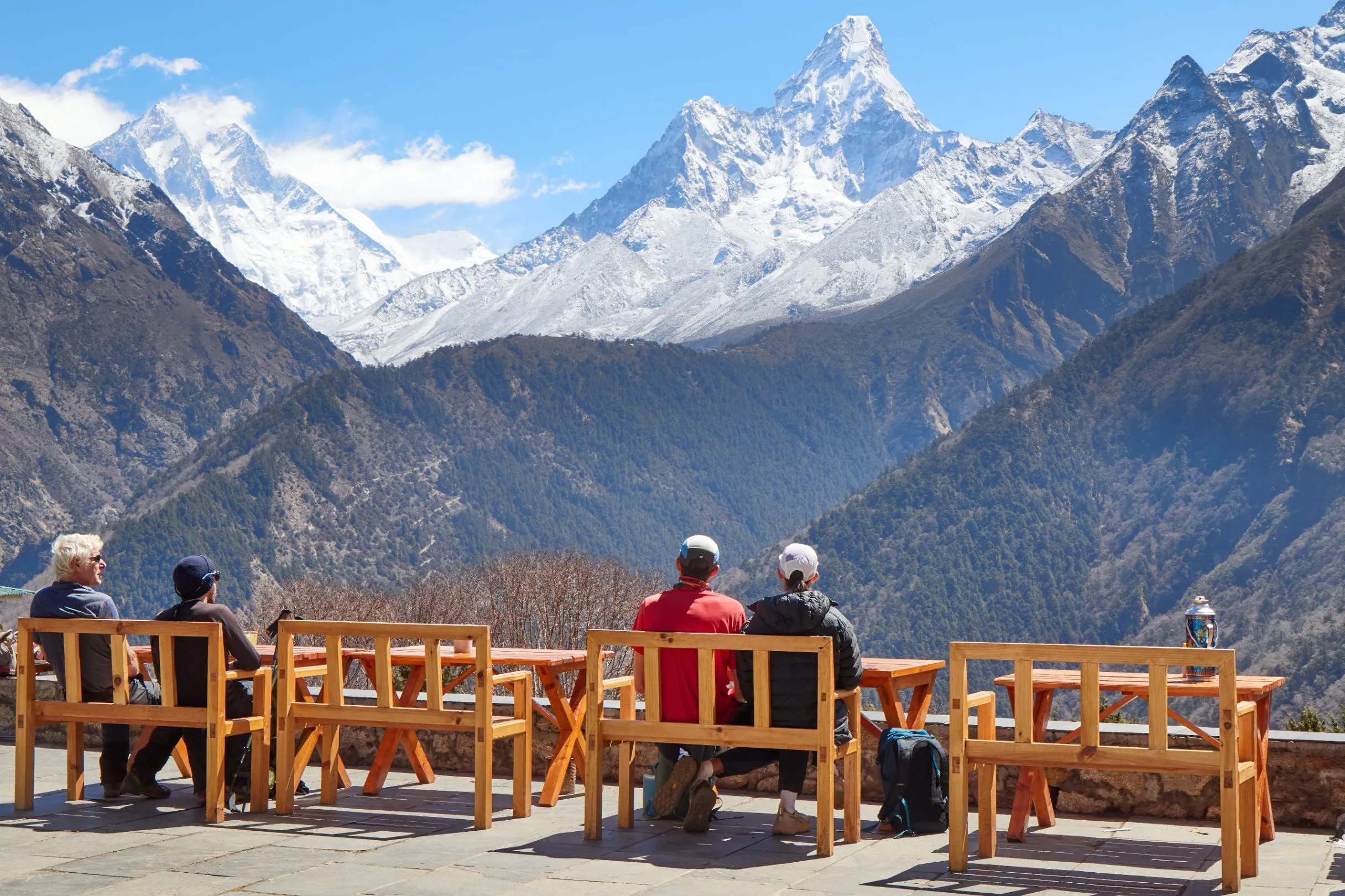
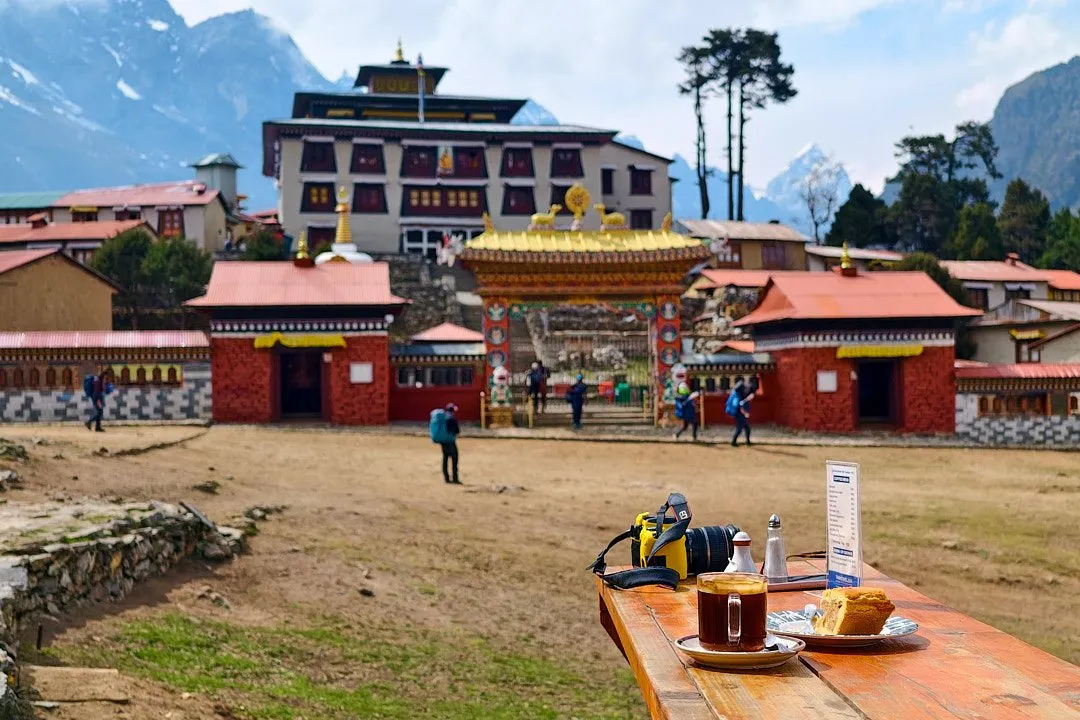
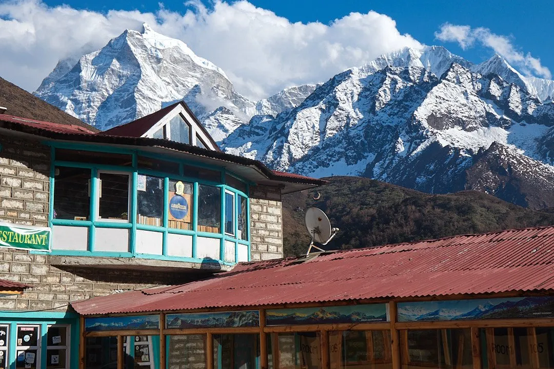
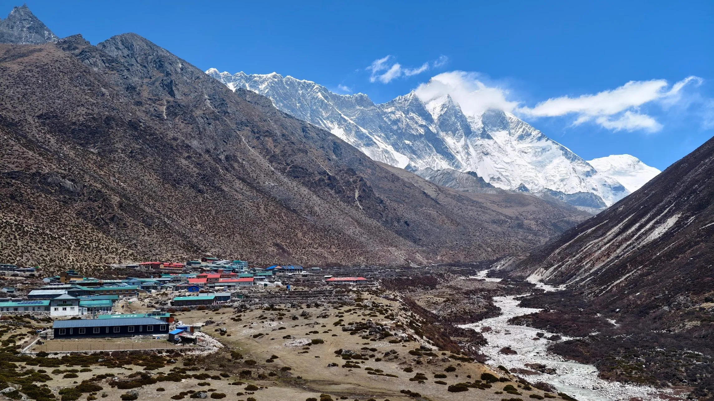
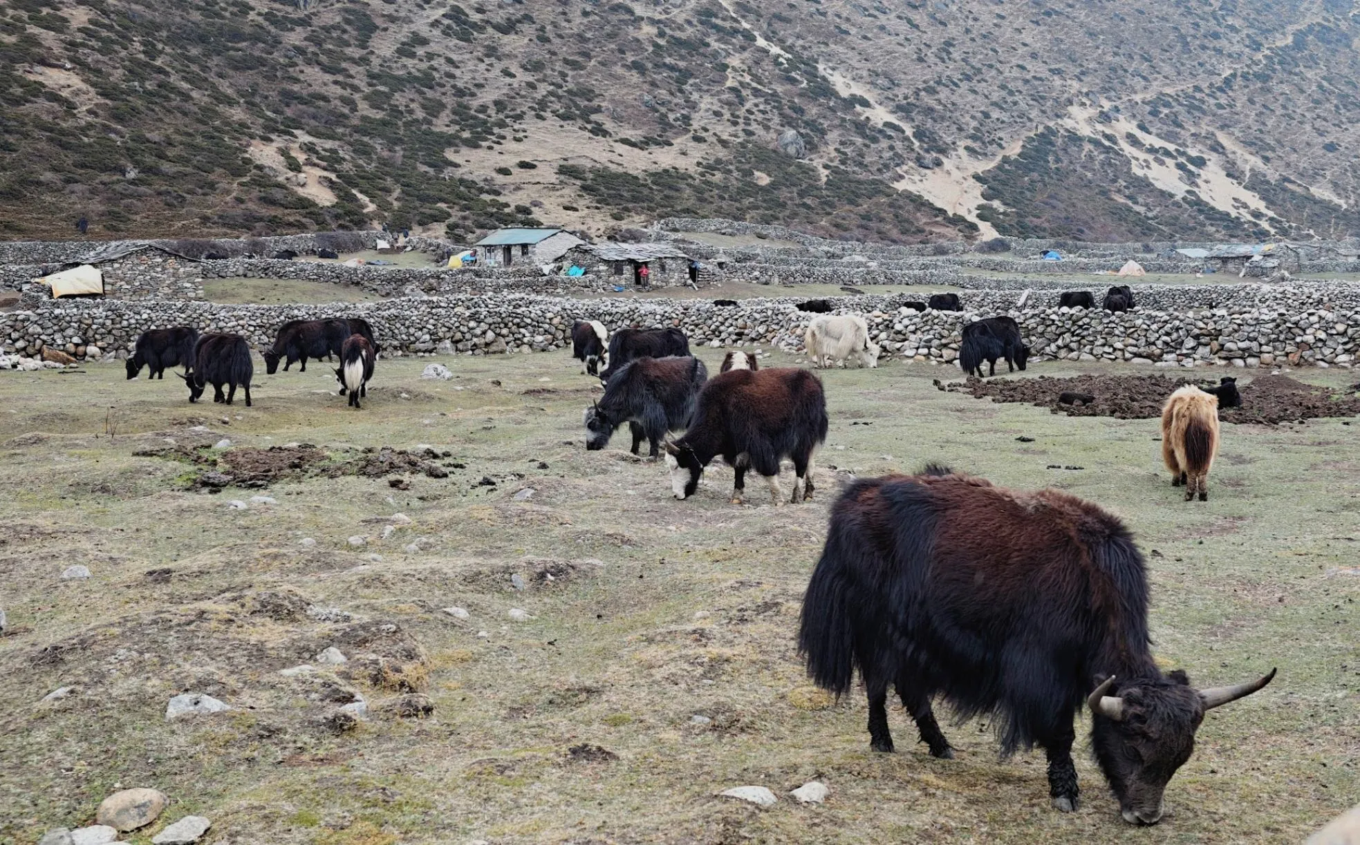
By Nepali standards, Namche Bazaar is considered a large mountain town, even though you can walk around it in about an hour. Namche Bazaar is the hub of the Khumbu region. You can learn about its history at the Sherpa Museum, dedicated to the Sherpa people who have historically lived in the Himalayas. Porters are often mistakenly called Sherpas, confusing a profession with an ethnic group (of which there are around a hundred in Nepal). Although many porters are indeed Sherpas. They are renowned for their endurance, strength, and ability to live and work at high altitude without discomfort. Porters who work on Everest routes are residents of mountain towns and villages. The museum is small, with just three rooms. The exhibits — mostly photographs and article clippings — tell the story of Sherpa culture and life, their achievements, existence in extreme conditions, and the history of the region as a whole. Namche Bazaar is the last outpost of comfort on the route. There are many restaurants, good coffee shops, and bakeries. You can find both local and European food. At the trendy café Sherpa Barista you can enjoy wood-fired pizza, and for coffee head to Himalayan Java Coffee. In town you can even book a massage, priced at around 50 dollars (50 USD).
If you forgot or did not have time to buy trekking gear in Kathmandu, it is best to pick it up here, as other villages do not offer such a selection. Namche Bazaar has brand-name stores selling Columbia clothing, genuine La Sportiva footwear and equipment, Black Diamond and Salomon gear, as well as the quality local brand Sherpa Adventure Gear. The town is also full of stalls selling knock-offs and no-name brands. Prices for clothing and gear will be slightly higher than in Kathmandu, but bargaining is possible.
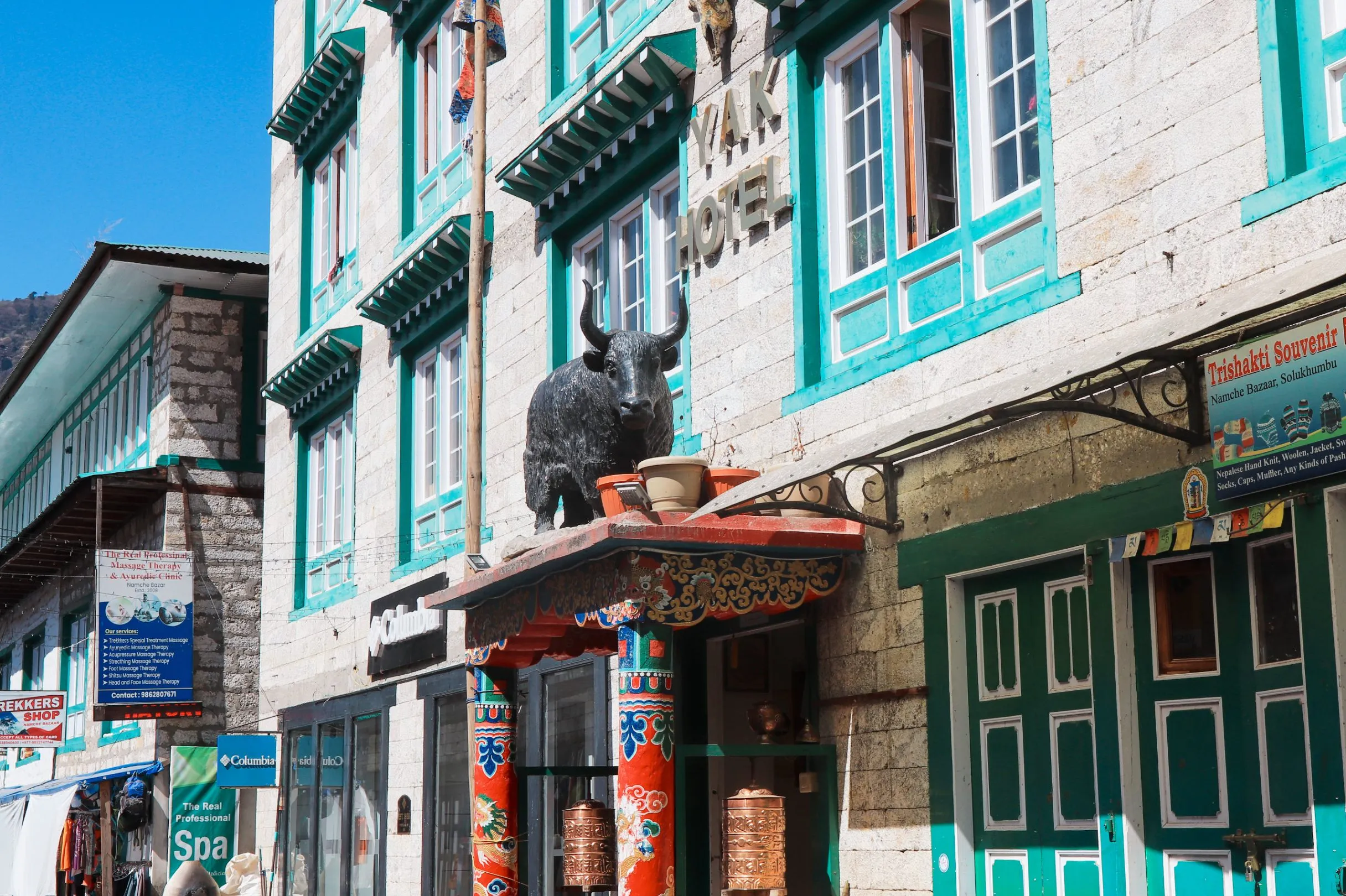
Namche Bazaar has the widest choice of accommodation on the route. Excellent views, good food (which is far from guaranteed at every lodge), and welcoming hosts await you at Khumbu Resort. A double room costs 500–1,000 rupees (3.27 USD–6.55 USD), some even have working power outlets, and a single dish costs 300–700 rupees (1.96 USD–4.58 USD). If you want a bit more comfort, we recommend the hotels Namche Terrace (which also has great views) and Yak Hotel — located right in the center, it is quite clean, has an en-suite bathroom with hot water, and excellent food (try the chicken pizza!). A night costs 3,800 rupees (24.9 USD), but you can bargain it down to 3,000 rupees (19.6 USD).
If on this day you walked from Monjo (around five kilometers with around 600 meters of elevation gain), you will have time to climb to a viewpoint — good views over Namche open up near Terrace Hotel and from the helipad.
Day 3: Acclimatization. Namche Bazaar — viewpoint overlooking Everest — Khumjung — Sagarmatha Next center
Eight kilometers
Several different treks start from Namche Bazaar, not only the one toward base camp. Trekkers typically spend two nights here, using the second day for a side hike to aid acclimatization.
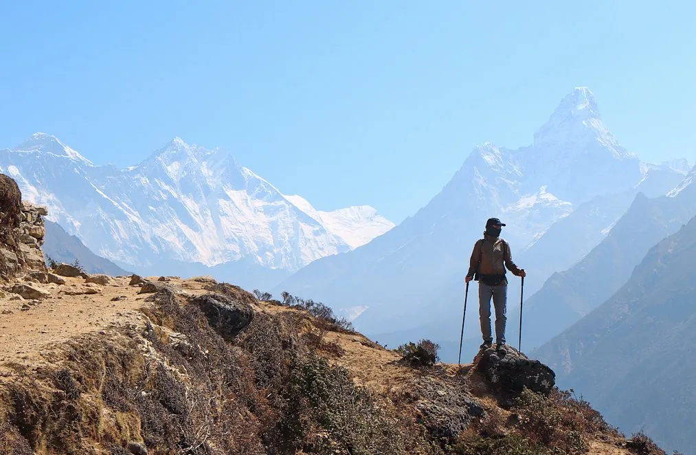
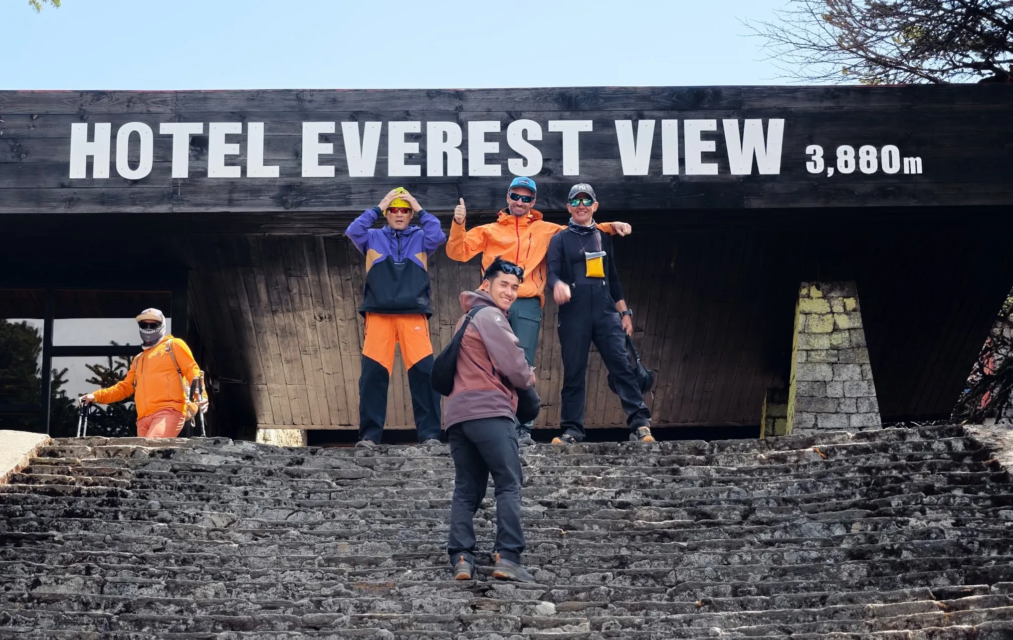
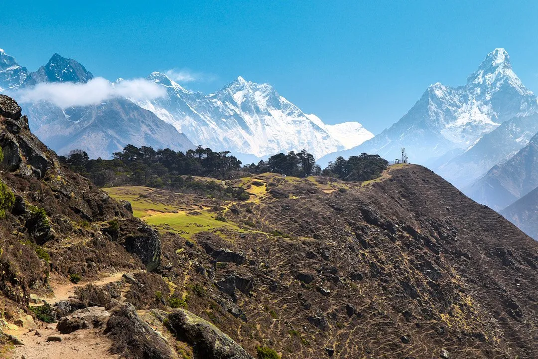
The most popular route is to the hotel Everest View with its views of Everest. The walk takes about two hours. Along the way there are several viewpoints with breathtaking views of Everest, Lhotse, and Ama Dablam.
At the Everest View Hotel itself you can have a coffee or tea (though prices here are steep), or continue a little further to the open-air viewpoints. As always in the mountains, it is best to plan the ascent for early morning, as clouds typically gather by midday.
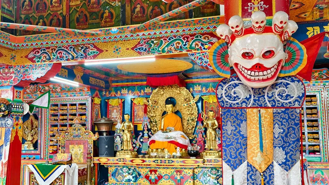
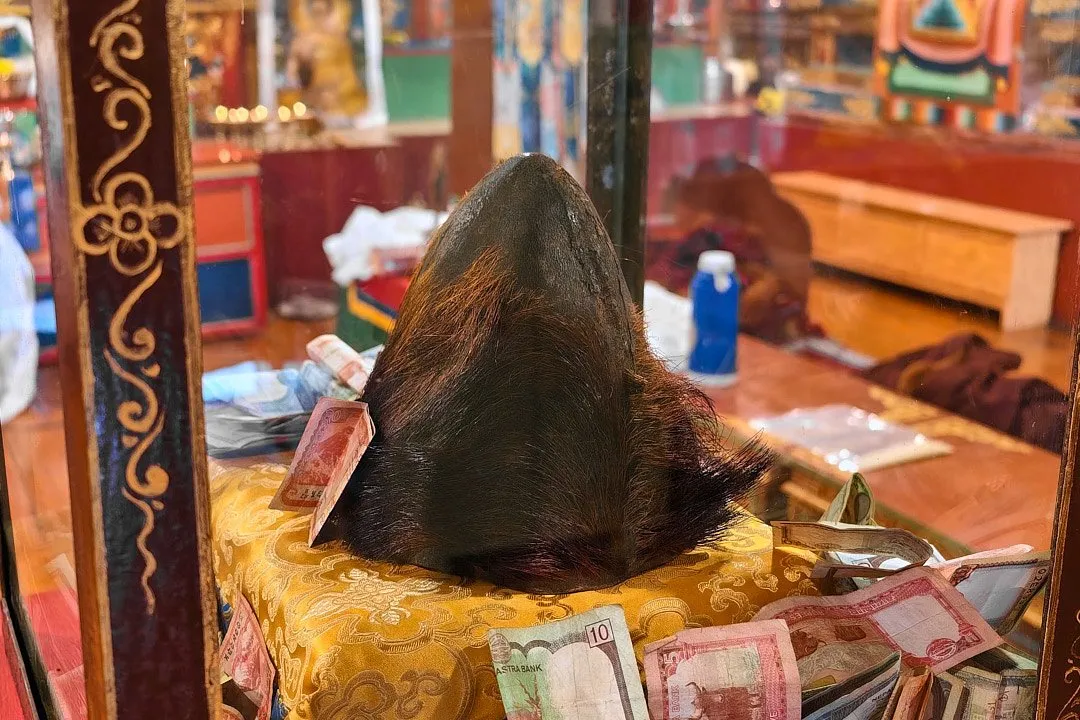
The acclimatization route can be extended to include the nearby village of Khumjung, famous for its monastery where, according to the monks, a yeti scalp is kept. The walk from the viewpoint takes about an hour — roughly three kilometers downhill.
Khumjung Monastery sits at an altitude of 3,700 meters. Foreign visitors are charged an entry fee of 300 rupees (1.96 USD). Photography inside the hall housing the yeti scalp used to be forbidden, but visitors are now free to take photos.
Khumjung is also home to a school founded by Edmund Hillary in 1961 — the first school in the region, which has provided education to generations of Sherpa children. On the school grounds stands a statue of Hillary and a small visitor center telling the story of his life, achievements, and humanitarian projects around the world.
The return path from Khumjung to Namche crosses a small pass at 3,868 meters. Beyond it lies the old runway of Syangboche Airport. It was built in the early 1970s as a gateway to the nearby Everest View Hotel, which at the time was the highest-altitude hotel in the world. The airport never became a rival to Lukla and is now used only for helicopter landings — bringing tourists to the hotel, evacuating medical emergencies, and delivering supplies to the local community.
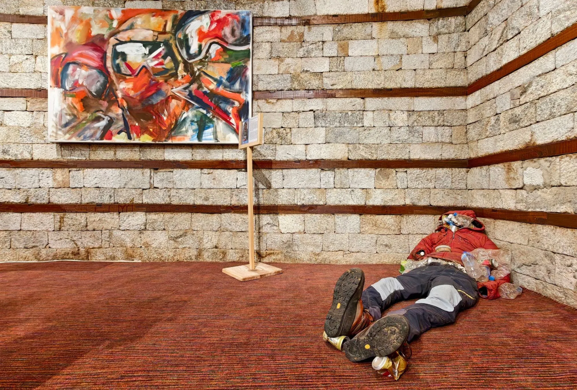
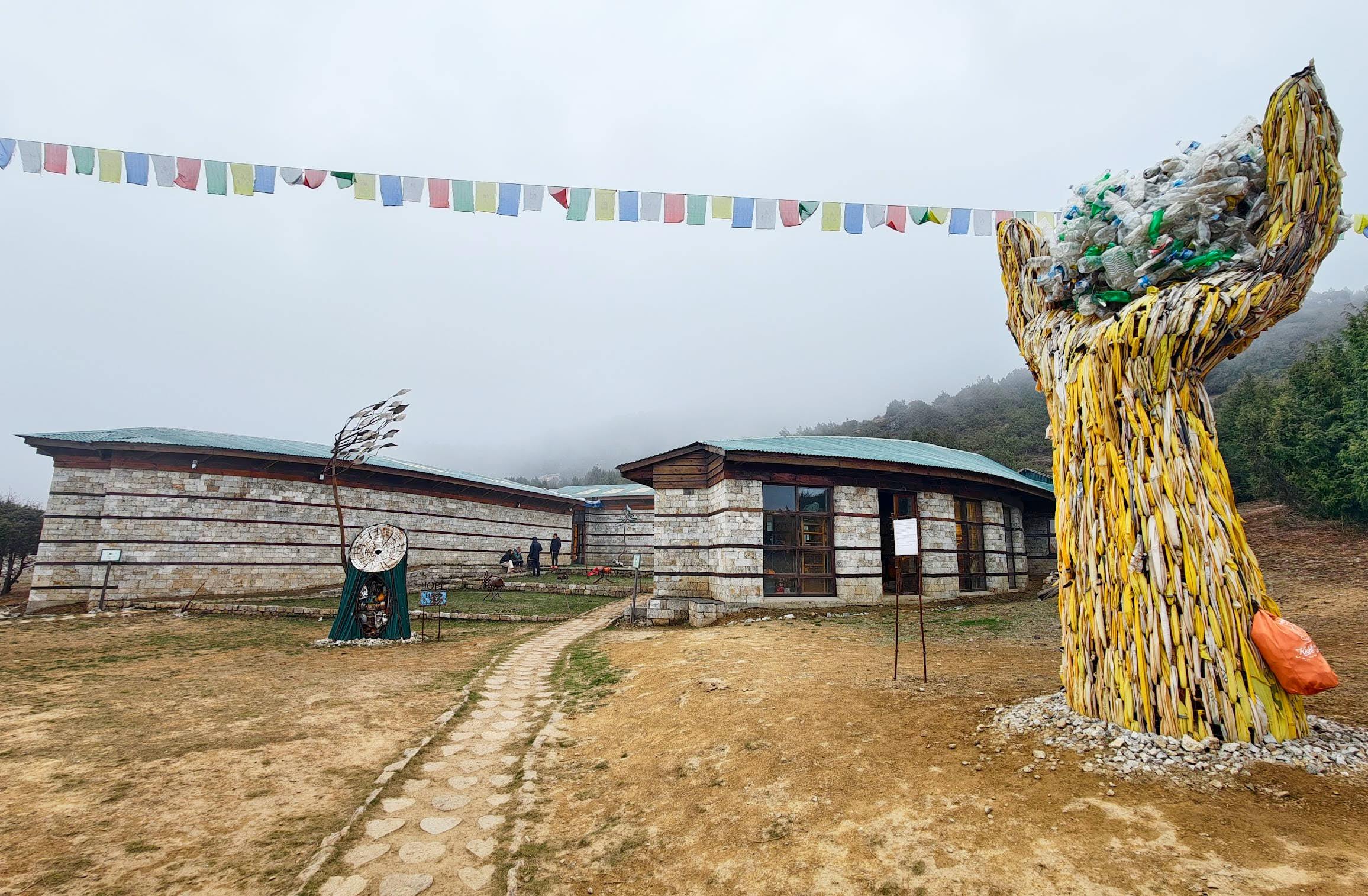
Beyond the airstrip is the Sagarmatha Next sustainable development center and art gallery. The center aims to address the problem of pollution in the Himalayas by transforming waste left by trekkers into works of art. Here you can "summit Everest" using a virtual reality headset, view art installations, buy souvenirs made from recycled waste collected in the mountains, and grab a coffee. The center is open from seven in the morning until four in the afternoon, and admission is free.
To the right above Namche Bazaar rises the Kongde Ri massif, with peaks exceeding 6,000 meters. Further left, along the trail toward Everest Base Camp, Lhotse is already visible (the fourth-highest mountain in the world at 8,516 meters), while the closest peak — and therefore the one that appears tallest — is Thamserku, standing 6,495 meters high. Standing out from the mountain panorama is Ama Dablam, just over 6,800 meters, easily recognized by its distinctive summit, which bears some resemblance to the Swiss Matterhorn with a cut-off peak.
Day 4: Namche Bazaar — Pangboche
12 kilometers
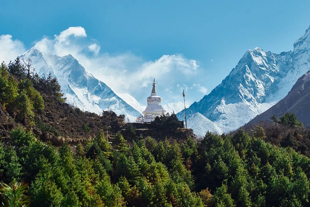
This is a long and demanding stretch that takes six to eight hours. The trail initially runs along the forest. A notable viewpoint along this section is a stupa set against the mountain peaks, adorned with colorful Nepali prayer flags. Nearby is another lookout with views of Everest.
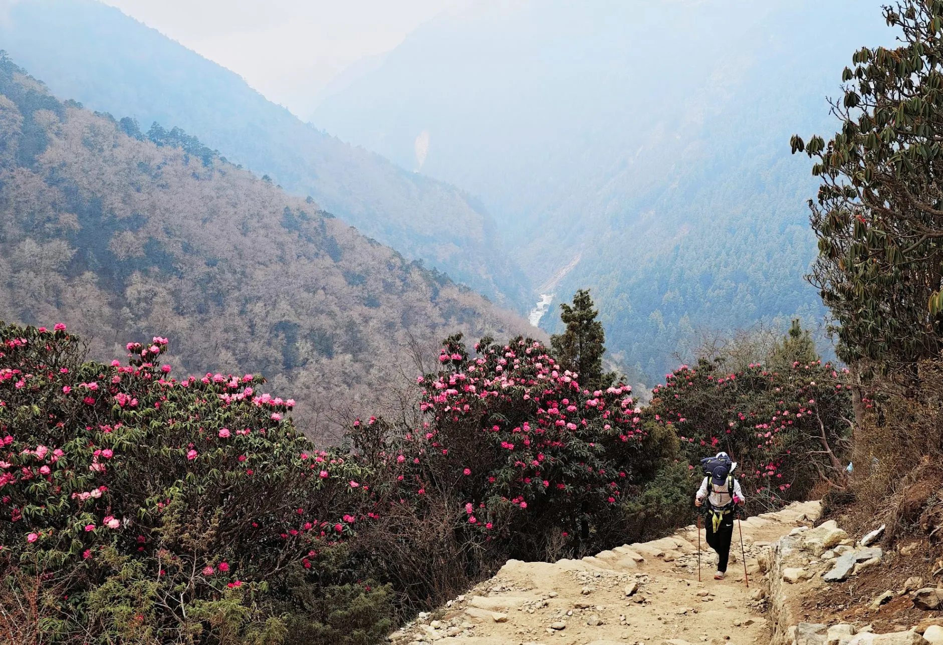
You can grab a bite in the small village of Kyangjuma, which offers incredible views of Ama Dablam, or descend to the river to rest before a long uphill climb. In spring, an entire grove of rhododendrons blooms here, visible from a distance as a bright pink splash on the mountainside.
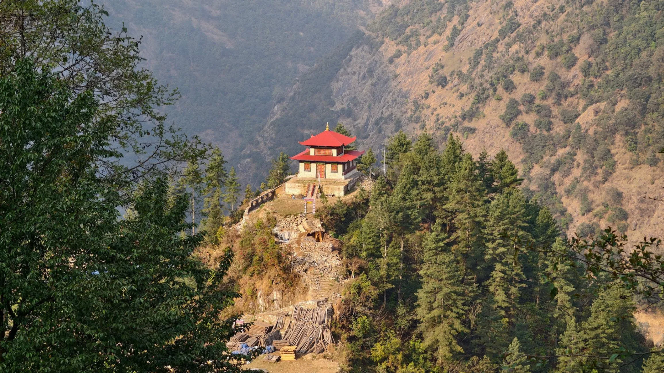
The climb ends at the small village of Tengboche, where you can have lunch and coffee at a café opposite the Tibetan Buddhist monastery. Tengboche Monastery was destroyed twice — in 1934 by an earthquake and in 1989 by fire — but was rebuilt both times. It is believed that all those heading to Everest Base Camp and the summit itself can receive a blessing here. Not far from the monastery lived one of the first two people to summit the world's highest peak — Edmund Hillary's porter, Sherpa Tenzing Norgay.
The villages of Tengboche and neighboring Deboche are very small, with literally just a handful of lodges each, so it is better to continue on to Pangboche, which has a couple of shops, cafés, and a decent choice of accommodation. On the approach to the village stands one of the most scenic bridges on the route, with views of Ama Dablam. For acclimatization in Pangboche, you can walk up to the monastery in the upper part of the village. It is considered the oldest monastery in the Khumbu region, reportedly built in the 16th century. Like other Buddhist monasteries, Pangboche Monastery is a complex of several buildings used for prayer, monks' quarters, and other religious practices. Admission costs 250 rupees (1.64 USD).
Mobile internet is still available in Pangboche, though the signal is patchy. Wi-Fi at the Everest Bakery Cafe is free, while lodges typically charge for hotel Wi-Fi access or require you to buy vouchers. We recommend Beyul Alpine Cottage — rooms with a private bathroom for 2,500 rupees (16.4 USD), power outlets, and fast Wi-Fi for 300 rupees (1.96 USD) — and the family-run Mountain View Lodge with a very welcoming host.
From Pangboche, the trail to Ama Dablam Base Camp begins, situated at an altitude of 4,500 meters. This is not part of the classic EBC route, but the occasional group does make the ascent there for acclimatization.
Day 5: Pangboche — Dingboche
Seven kilometres
The leg to Dingboche is a short one. Along the way you can stop for lunch in the village of Somare. The trail winds through mountain valleys and crosses a river. Dingboche feels hemmed in by mountains on all sides — Lhotse looms on one side and Ama Dablam on the other. For acclimatization, you can hike up to one of the stupas on the ridge above the village. The weather becomes noticeably changeable in Dingboche: the peaks are often shrouded in cloud by the afternoon, and snow can occasionally fall.
The village has around a dozen lodges, several shops, and a large Café 4410, where you can grab a bite and a drink, and a bakery called Hana — it serves delicious hot chocolate, offers free charging, and has Wi-Fi with orders from 500 rupees (3.27 USD), though the Wi-Fi is patchy. Mobile signal no longer reaches Dingboche.
Prices are noticeably higher here. Lunch for two will cost around 1,800 rupees (11.8 USD), two teas and a slice of cake — 1,000 rupees (6.55 USD). Accommodation runs 600–900 rupees (3.93 USD–5.89 USD) per room per night and 2,500–3,000 (16.4 USD–19.6 USD) for a room with a private bathroom. At the lodge The Mountain Heritage Inn the food is nothing special, but a room with a very hot shower will set you back 3,000 rupees (19.6 USD) per night — if you stay two nights you can often negotiate it down to 2,500 (16.4 USD). There is a power socket in the room, even though at this altitude electricity is generated solely by solar panels. The Wi-Fi from Hana Café also just about reaches the lodge kitchen.
Day 6: Acclimatization. Dingboche — Nangkartshang Peak
Four kilometers
Dingboche sits at an altitude of 4,360 meters, and trekkers typically stay an extra day here to complete an acclimatization hike. Nangkartshang Peak rises to just over 5,000 meters. The ascent is steep and takes around three hours. It is best to head up in the morning — in good weather you can see Makalu (8,463 meters), the world's fifth-highest peak, from the summit.
Day 7: Dingboche — Lobuche
Eight kilometres
Each day the altitude makes walking harder. The stretch from Dingboche to Lobuche passes with views of the village of Pheriche, which sits below in the river valley. The first part of the route crosses hilly terrain with modest elevation changes and scenery dominated by dark mountain massifs. After crossing to the other bank of the river, you can stop for lunch or pick up a packed lunch at a lodge before the climb ahead. The ascent is not particularly long (around 40 minutes), but by this point walking is already quite strenuous.
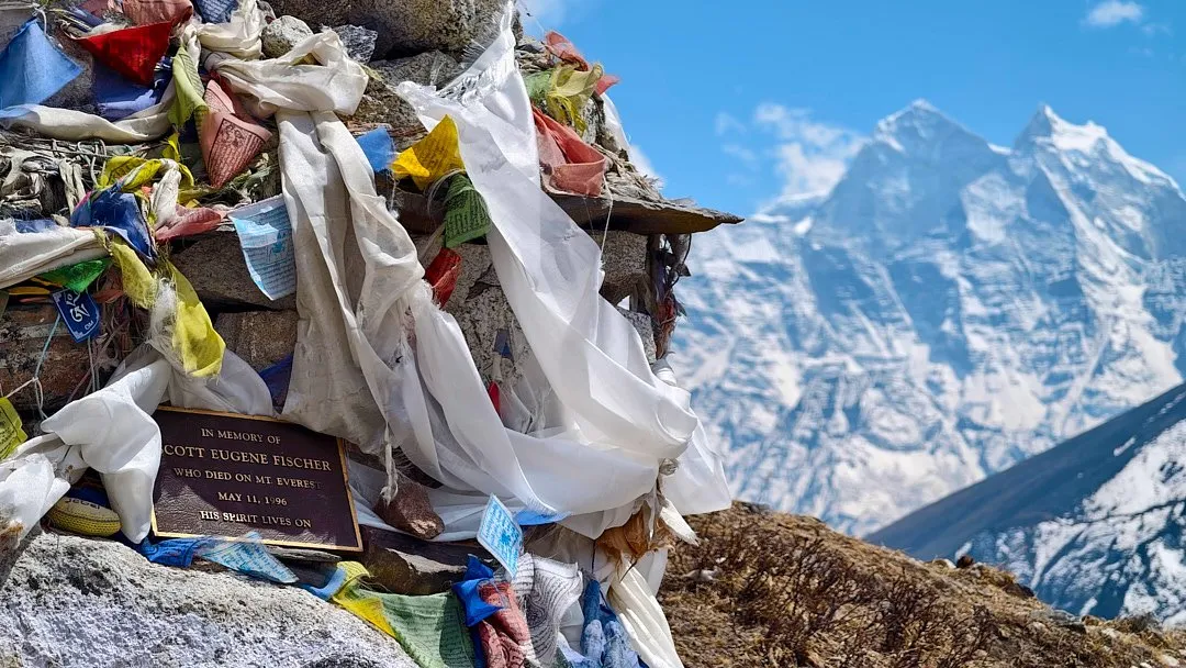
From the Thukla Pass, fantastic views open up over the valley and the six-thousanders. Hundreds of makeshift memorials to climbers who died on Everest are located here. One of the most well-known memorials is dedicated to Scott Fischer. Several books have been written about the 1996 expedition he led, and the film Everest was made about it. At the same time, a group led by Rob Hall was also ascending — unlike Fischer, it was not Hall's first experience guiding clients on Everest. The instructor in Hall's group was Soviet mountaineer Anatoli Boukreev. Both groups failed to reach the summit in time, and on the descent the weather turned. During the night, without supplemental oxygen, Anatoli Boukreev managed to save three people by bringing them to the nearest camp. Fischer and Hall perished. In the memorial valley you can find plaques dedicated to them, other guides, Sherpas, and participants of those expeditions.
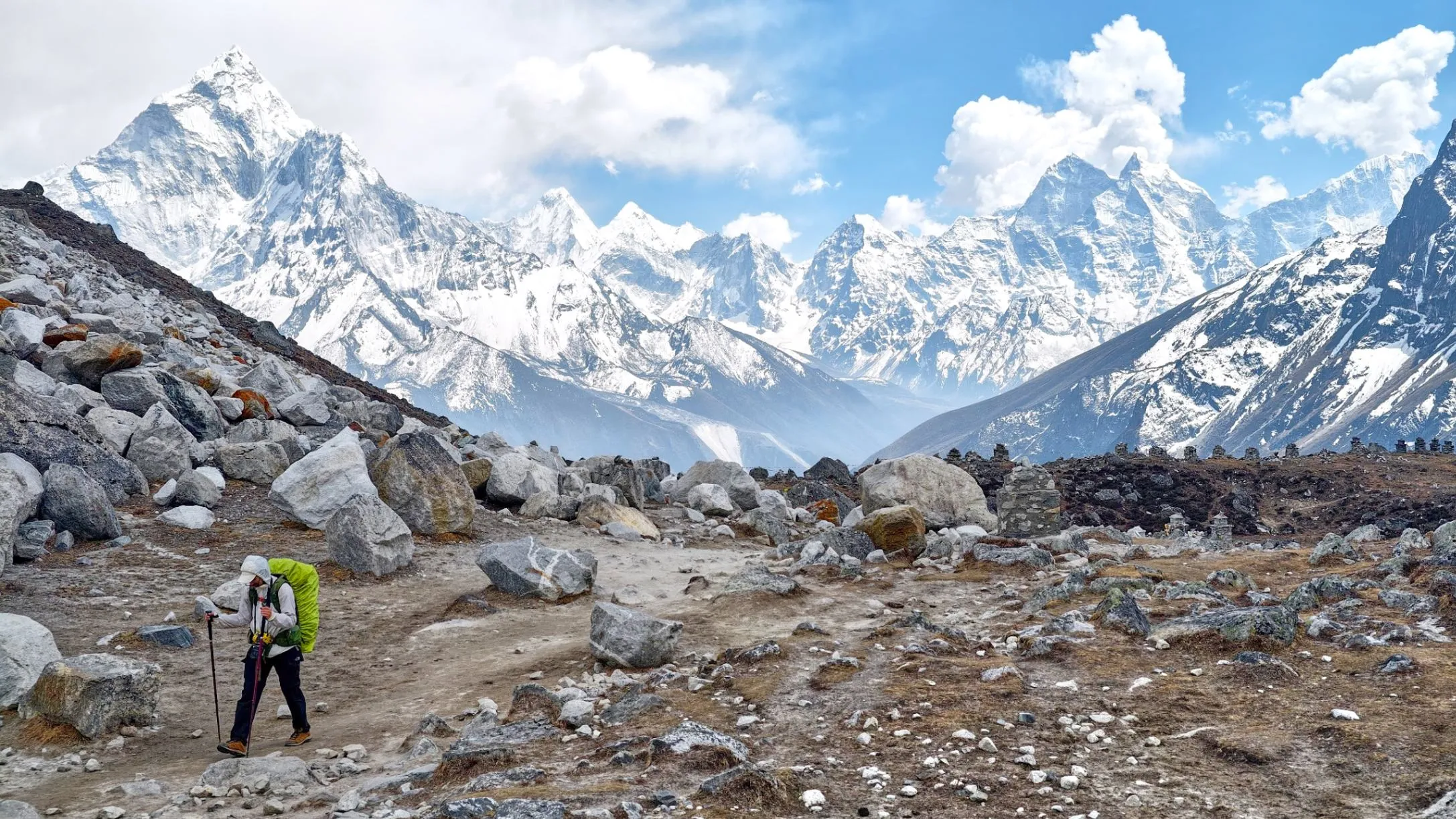
After the pass, the trail descends slightly into the valley to the village of Lobuche, and there are no more significant climbs after that. To acclimatise in Lobuche, trekkers usually ascend a rise on the opposite bank of the river. From the top, sweeping mountain panoramas open up, along with otherworldly views of the glaciers, and in the distance Everest Base Camp is already visible.
Lobuche sits at 4,940 metres, so there are almost no permanent residents here and all the infrastructure is geared exclusively towards trekkers. There are fewer than ten lodges, and during high season many of them will be filled by large tour groups. You can stay at The Altitude Home — a room without facilities at this altitude already costs 1,000 rupees (6.55 USD), and the prices for charging devices are as follows: smartphone — 500 rupees (3.27 USD), power bank up to 10,000 mAh — 900 rupees (5.89 USD), over 10,000 mAh — 1,500 (9.82 USD).
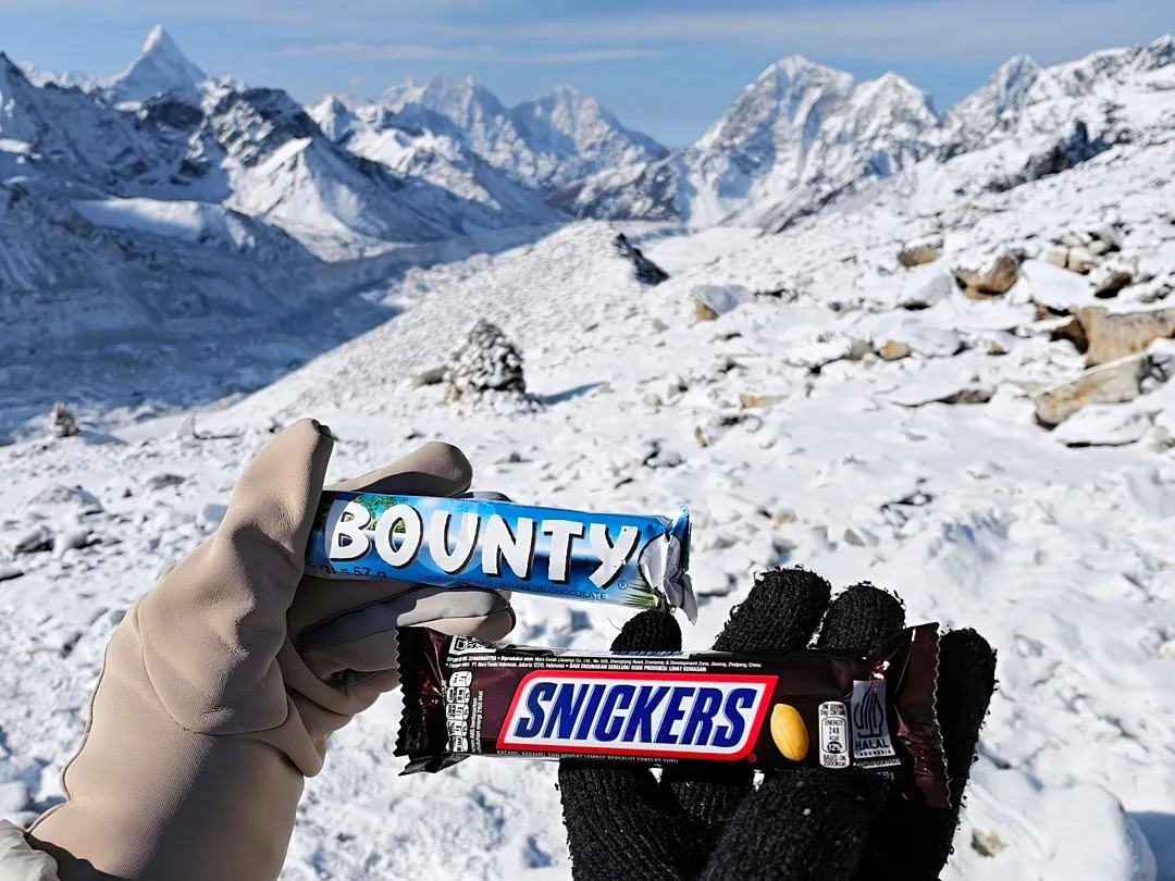
Lobuche has a shop where you can buy high-calorie snack bars more cheaply than in Gorakshep: Snickers and Bounty bars cost 300–350 rupees (1.96 USD–2.29 USD), a bottle of water — 250 rupees (1.64 USD). In Gorakshep the price of a bottle will already be 400 rupees (2.62 USD).
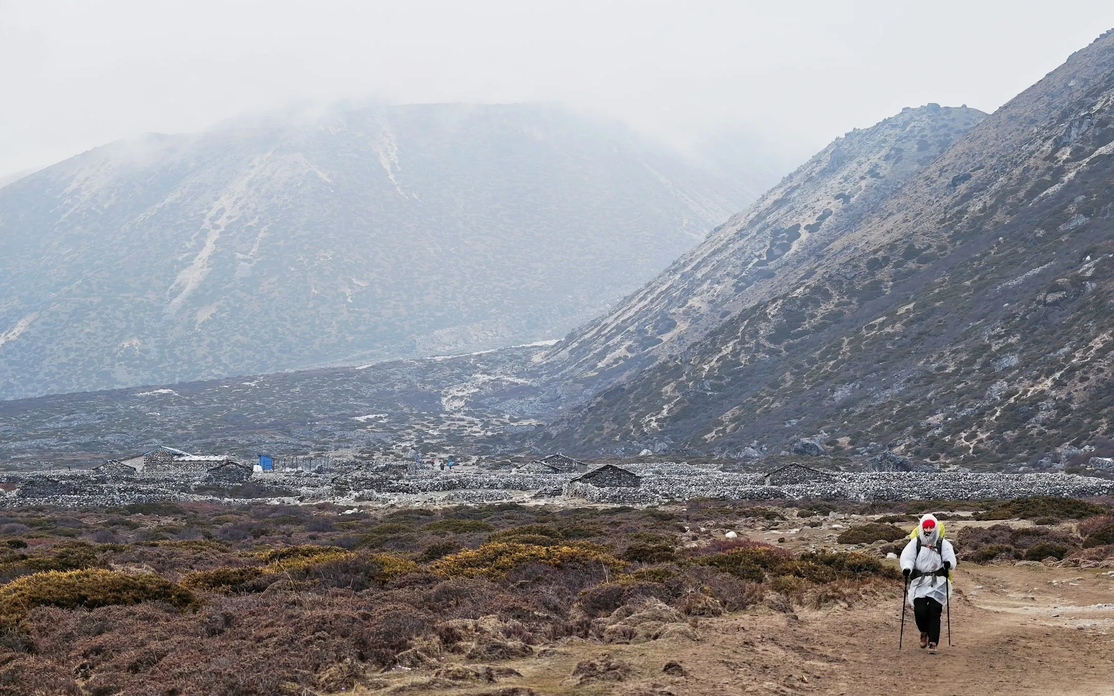
Day 8: Lobuche — Gorakshep — Everest Base Camp
12 kilometres
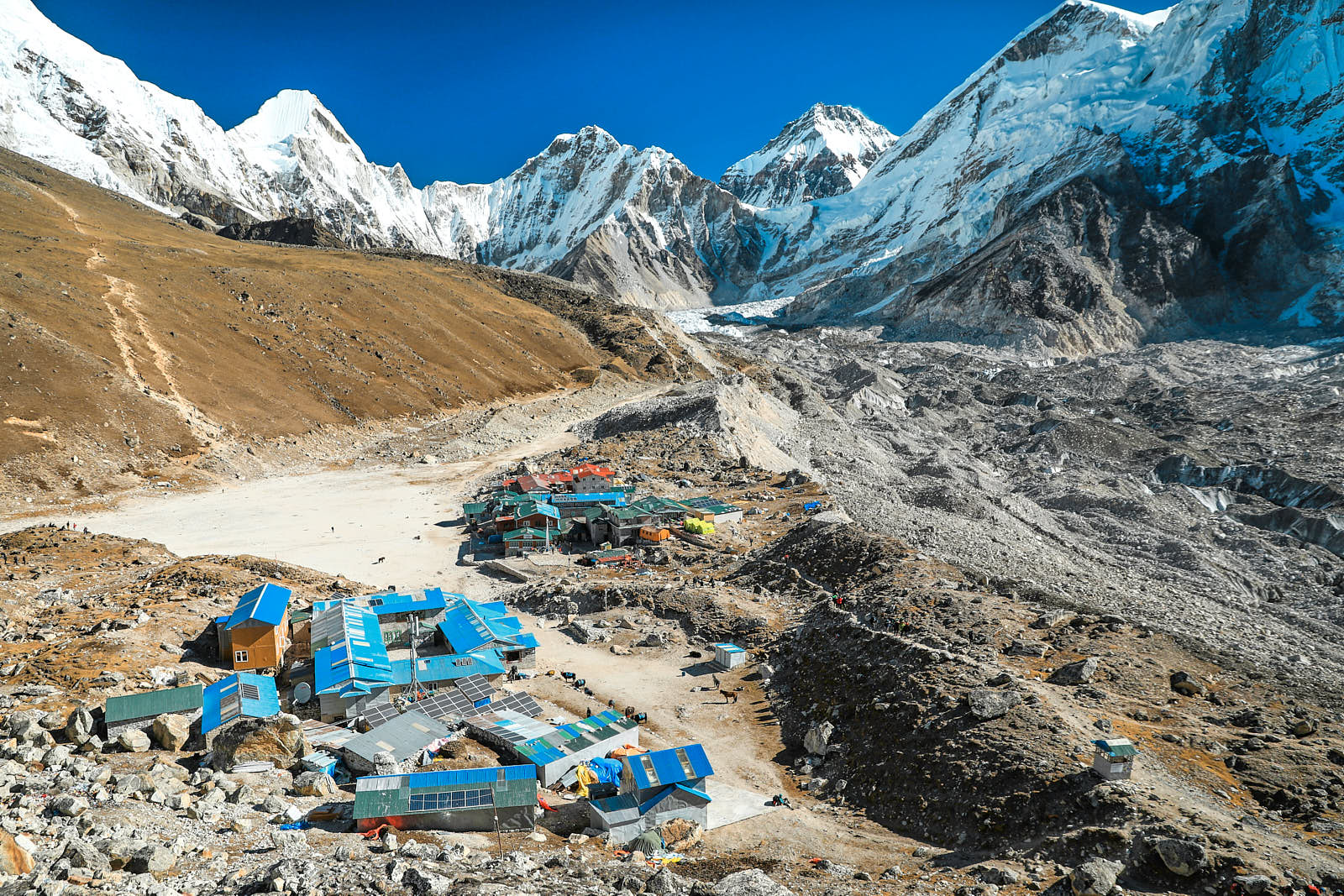
The ascent to Everest Base Camp is usually combined with the transit day from Lobuche to Gorakshep. Accommodation and food in the highest settlement in Nepal are the most expensive along the entire route, and the living conditions are less comfortable, so most trekkers try to spend no more than one night there.
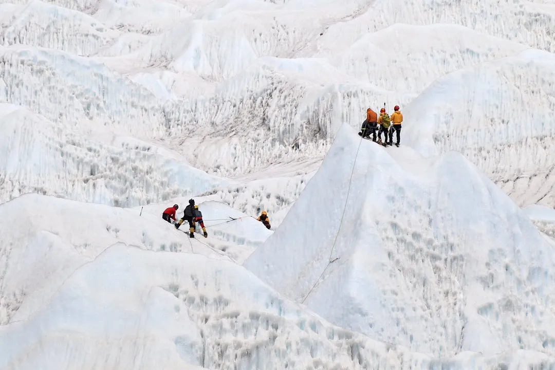
You will need to leave Lobuche as early as possible — around six in the morning. The path to Gorakshep has no major elevation changes or steep climbs. However, on some sections you are literally picking your way over rocks and queuing in traffic jams of climbers, Sherpas, yaks, and horses, which are especially numerous here.
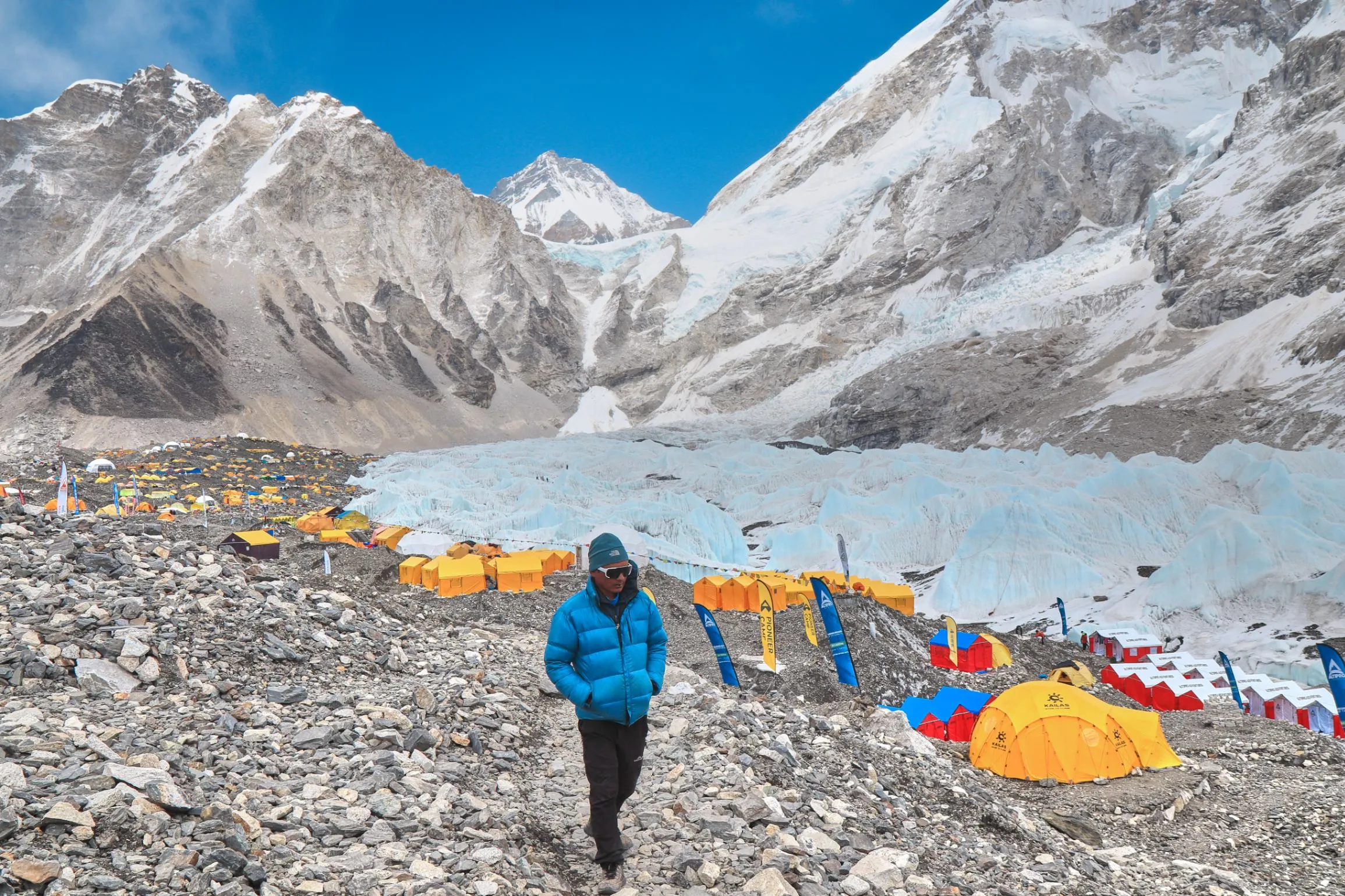
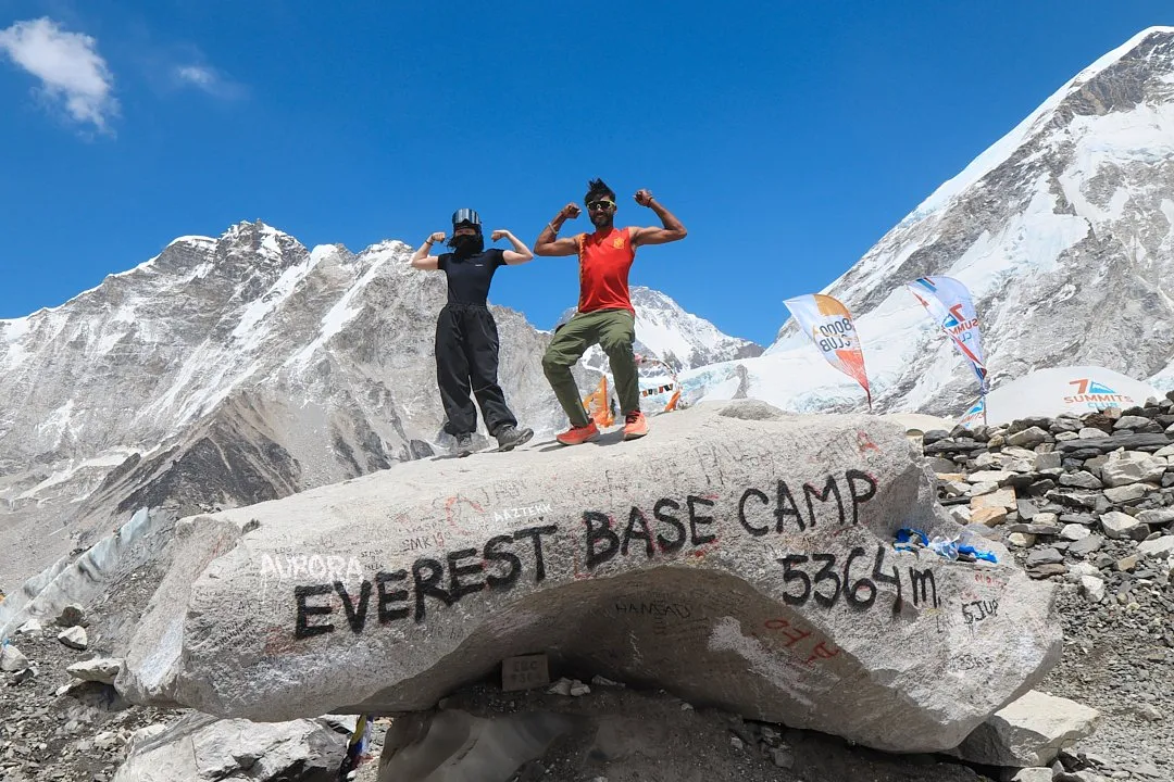
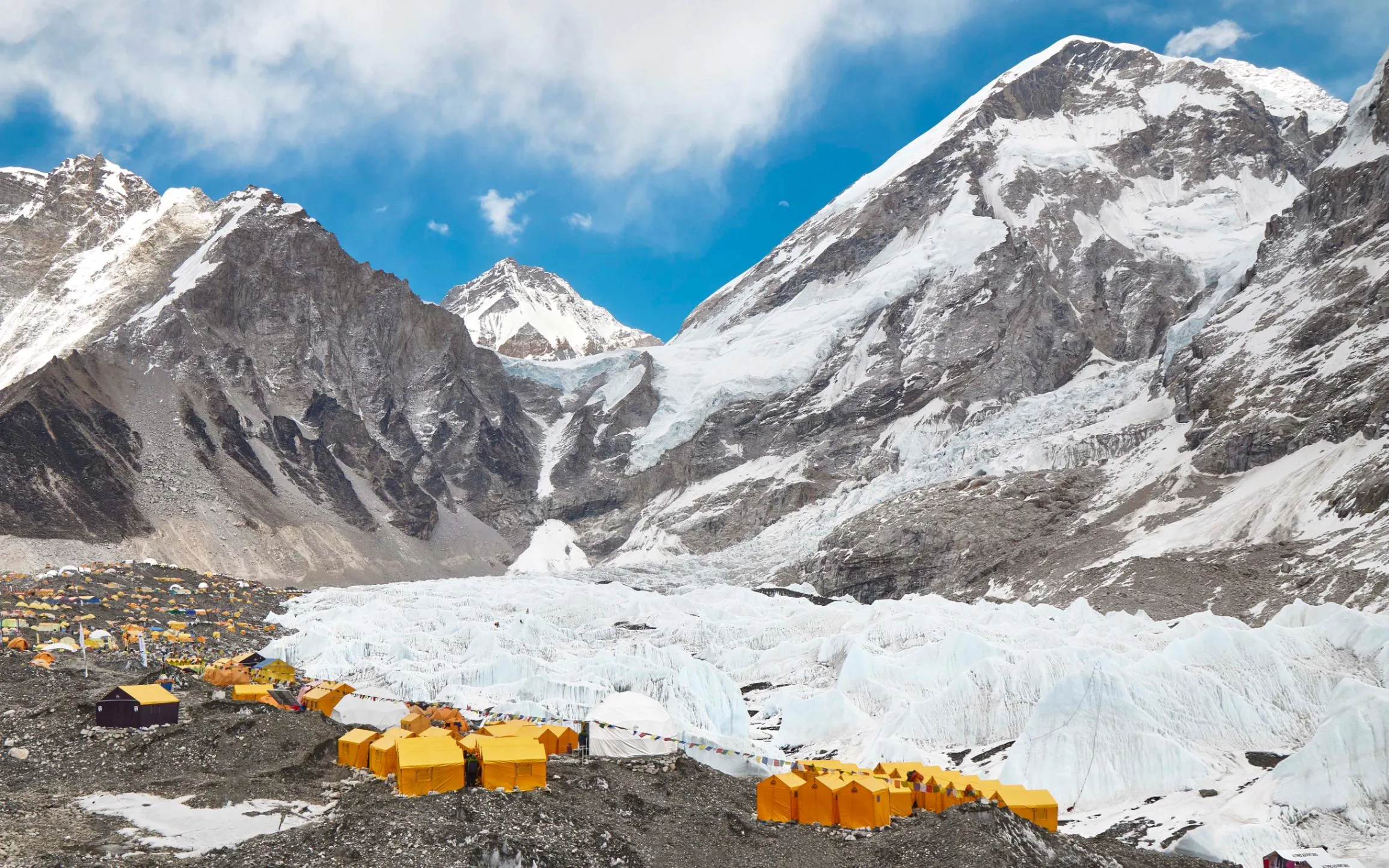
A huge boulder marks the spot behind which Everest Base Camp lies — the final point of the trek. The brightly coloured yellow tents of the climbers, visible from a distance, are located closer to the Khumbu Icefall — in clear weather you can watch climbers training on it. The mountaineers' camp is set up only in spring; in autumn it is empty. From a certain angle you can take a photo on the boulder with Everest in the background, though you may have to wait in a short queue for your turn.
There are no barriers or checkpoints in the camp, so you can freely walk among the tent camps of the various expedition companies — just be mindful of the etiquette. It is not advisable to linger at Everest Base Camp after two or three in the afternoon, as the weather usually starts to deteriorate and you will have far less energy on the way back to Gorakshep.
Gorakshep sits at an altitude of 5,164 metres, so temperatures drop below zero at night — and often during the day as well. This creates several problems. The first is the absence of running water: all water has to be carried from sources and stored in barrels, which also frequently freeze overnight. Many lodges have toilets on the upper floors but no washbasins; these may be on the ground floor near the kitchen or outside altogether. The second problem is cleanliness. It is quite difficult to maintain with no reliable electricity or water supply, so the blankets even in more expensive lodges will be dirty — just accept it.
If you are worried about the cold, look for a lodge with electric blankets — these are definitely available at Everest Inn, where a room costs 7,000 rupees (45.8 USD); bargaining is appropriate. You can also charge your devices there.
There are many complaints online about the quality of the local water, so it is better to use bottled water for brushing your teeth. There is a small shop in Gorakshep where a one-litre bottle of water costs 400 rupees (2.62 USD). Incidentally, boiled water in the lodges here is also of questionable quality and is the most expensive on the entire route — a litre will cost you 800 rupees (5.24 USD).
Surprisingly, mobile internet reappears in Gorakshep, although it is quite weak. It is enough, however, to read and send messages in messengers.
Day 9: Gorakshep — Kala Patthar — Pheriche
15 kilometres
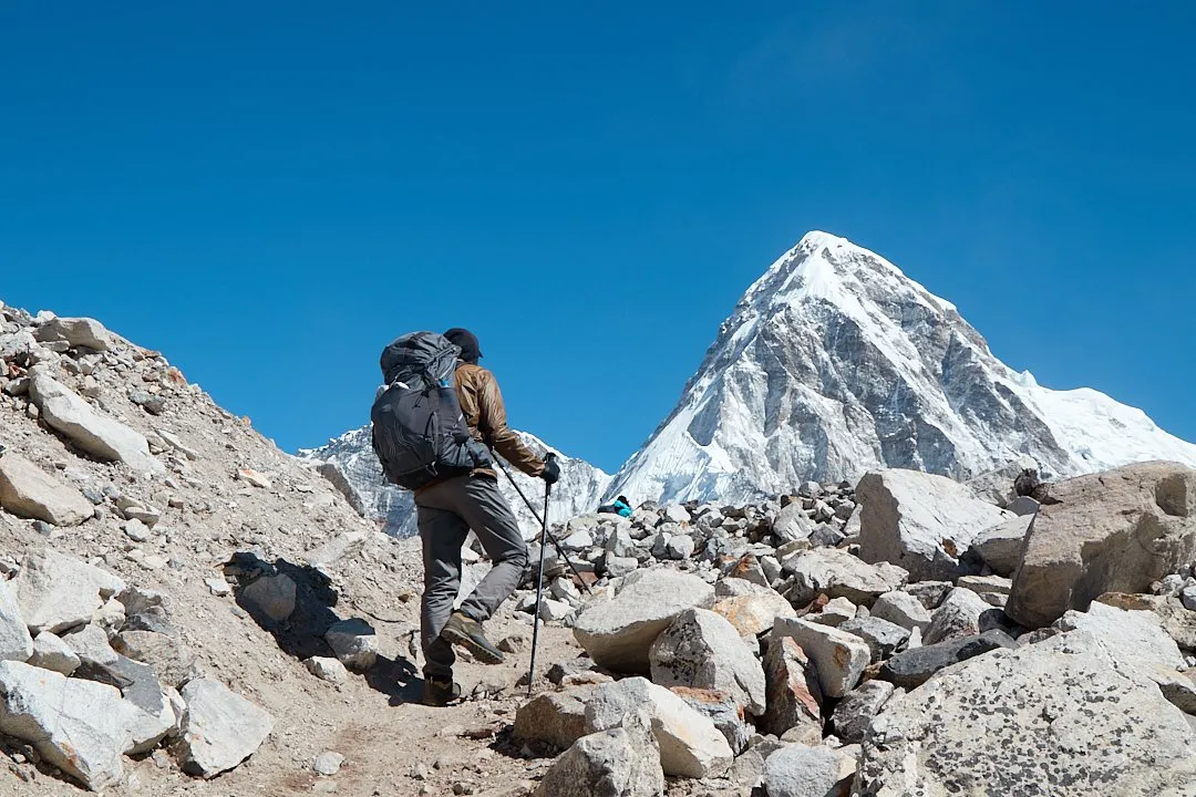
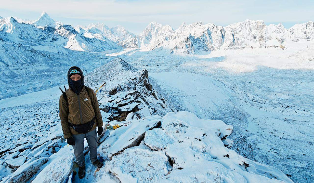
Trekkers set out for Kala Patthar a few hours before dawn to catch Everest free of clouds and in the first rays of sunlight, before the weather turns. The ascent begins from Gorakshep without packs. Breakfast is usually eaten after returning. There are benches along the path up for rest stops. The climb to the summit takes around two hours. Kala Patthar stands at 5,644 metres.
The return route is planned according to each trekker's energy and how they are feeling. Some stop in Lobuche, others push on a little further to Pheriche. Near Pheriche on overcast days you can observe Icelandic-like scenery: low shrubs grow around the village, the valley is ringed by dark mountains, and yaks graze against that backdrop. Along the way you pass through a very authentic, non-touristy village of a dozen stone houses. With the will and stamina you can continue all the way to Pangboche, especially if you are short on time, but if you decide to stop in Pheriche, here is a decent lodge with good food and rooms for 500 rupees (3.27 USD) (without power sockets, however) — Panorama.
Day 10: Pheriche — Namche Bazaar
19 kilometers
This leg can also be split into two days, but it is quite realistic to complete in a single day. At checkpoints along the return route you can buy a certificate of trek completion for 700 rupees (4.58 USD). In Namche on the way back, trekkers typically buy souvenirs, relax, treat themselves to a massage or sauna, and sit in restaurants celebrating a successful trek.
Day 11: Namche Bazaar — Lukla
17 kilometers
This leg is fairly long and takes six to eight hours. You can have lunch in any village along the way. It is even possible to get a room with a private shower and toilet here — for example, at Everest Eco Lukla for just 1,000 rupees (6.55 USD), though it is better to shower before sunset, as the water is heated by solar panels.
Many travelers buy open-dated plane tickets to Kathmandu. The departure must be confirmed at the airport one day in advance. Since not everyone has time to spend an extra day in Lukla, this service is available for a small fee at Namaste Lodge. You can write or call, and their staff will go to the airport on your behalf and confirm the flight while you are still walking to Lukla — as long as you are certain you will make it in time for the next day's departure.
Those leaving by jeep rather than flying will need to descend from Lukla to Surke the following day, which takes about an hour and a half. Jeeps from Surke usually depart at eight in the morning, so you should leave Lukla right after an early breakfast. A couple of days before your return — typically from Namche Bazaar — message the driver who brought you to the start of the trek (it is a good idea to get their WhatsApp number) and let them know which day you want to leave. Even if they are busy, they will pass you on to another driver heading out that day.
Jeeps arrive in Salleri at around 4–5 p.m. It is possible to continue straight to Kathmandu, but that requires a full jeep booking — 20,000 rupees (130.9 USD), which can be split among everyone traveling. If nothing unexpected happens along the way, you will be in Kathmandu by four in the morning.
How to Get to Nepal
By plane. Nepal's only international airport — Tribhuvan — is located in the capital, Kathmandu.
By land. There are seven border crossings between Nepal and India open to foreign nationals: Belahiya, Biratnagar, Birgunj, Gadda Chauki / Bhimdatta, Kakarbhitta, Milan Chowk (Mohana), and Nepalgunj. However, there is a catch: all of them allow exit from India, but entry into Nepal is only possible through some of them. It is important to verify this information carefully before your trip. Many border crossings also do not operate around the clock, so this is worth checking in advance as well. A second nuance: if you have an Indian e-visa that has not yet been activated, you can only exit through the Birgunj crossing. Other crossings will not let you through.
In general, despite the relatively small number of foreigners — and locals who often cross without registering at all — crossing the border overland is a slow process, mostly on the Indian side. Between the dozen pointless questions, having your details entered into a ledger twice, and your passport flipped through multiple times, a couple of hours can easily pass. On the Nepali side things are usually much faster, especially if you have paid for your visa in advance. It is also not always obvious which of the run-down buildings is the border control office, so just walk into whichever one looks like a checkpoint. The borders are so chaotic that crossing without entry or exit stamps is quite easy to do.
With China there are three border crossings: Rasuwagadhi, Hilsa, and Kodari. All of them lead into the Tibet Autonomous Region, which foreign nationals are not permitted to enter independently — a guided tour is required.
When to Go
Spring and autumn are the most comfortable seasons for trekking to Everest Base Camp. Summer treks are avoided due to frequent rain and heavy cloud cover, while winter brings snow and cold at high altitudes. In early March, for example, there is still snow on the ground in Namche Bazaar.
Late March through mid-May is the best time for the trek. During this period, magnolias and rhododendrons — plants that are symbols of Nepal — bloom along the route. Entire groves of bright pink bushes can be found throughout the first part of the trail.
Autumn is recommended for those who want to see the Gokyo Lakes. While they may still be frozen in spring, after the warm summer they can be admired in their full splendor. In autumn, all the passes on more challenging routes are also open, whereas snow may still linger on them in spring.
The Himalayas are beautiful in any trekking season, so choose the time that suits you best and build in a few extra days to allow for bad weather.